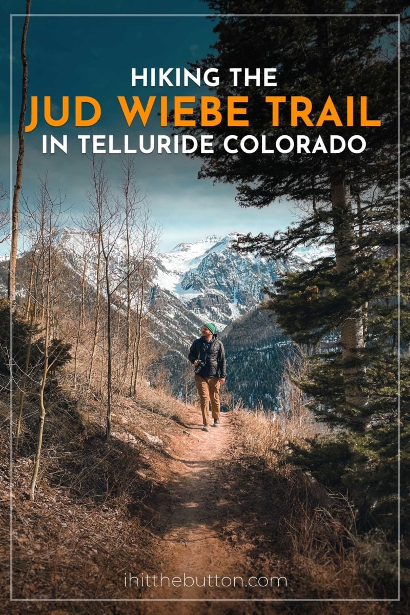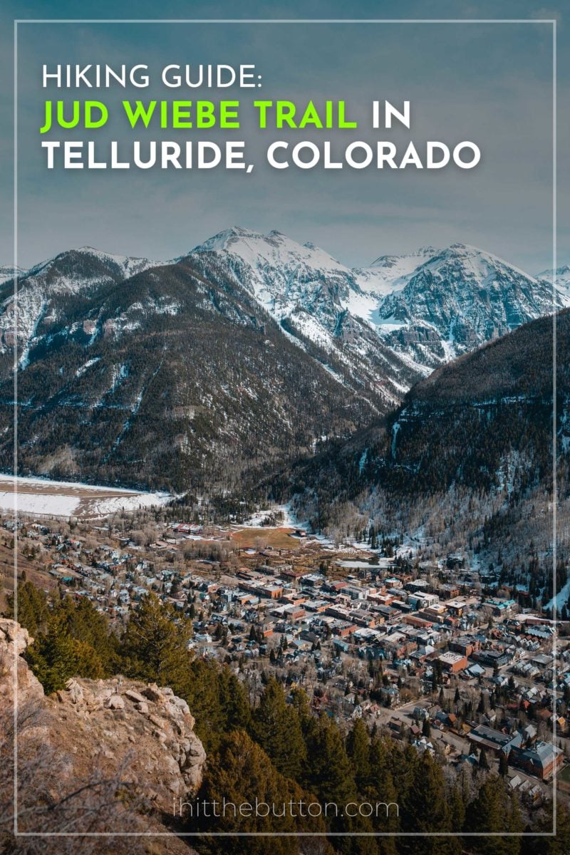
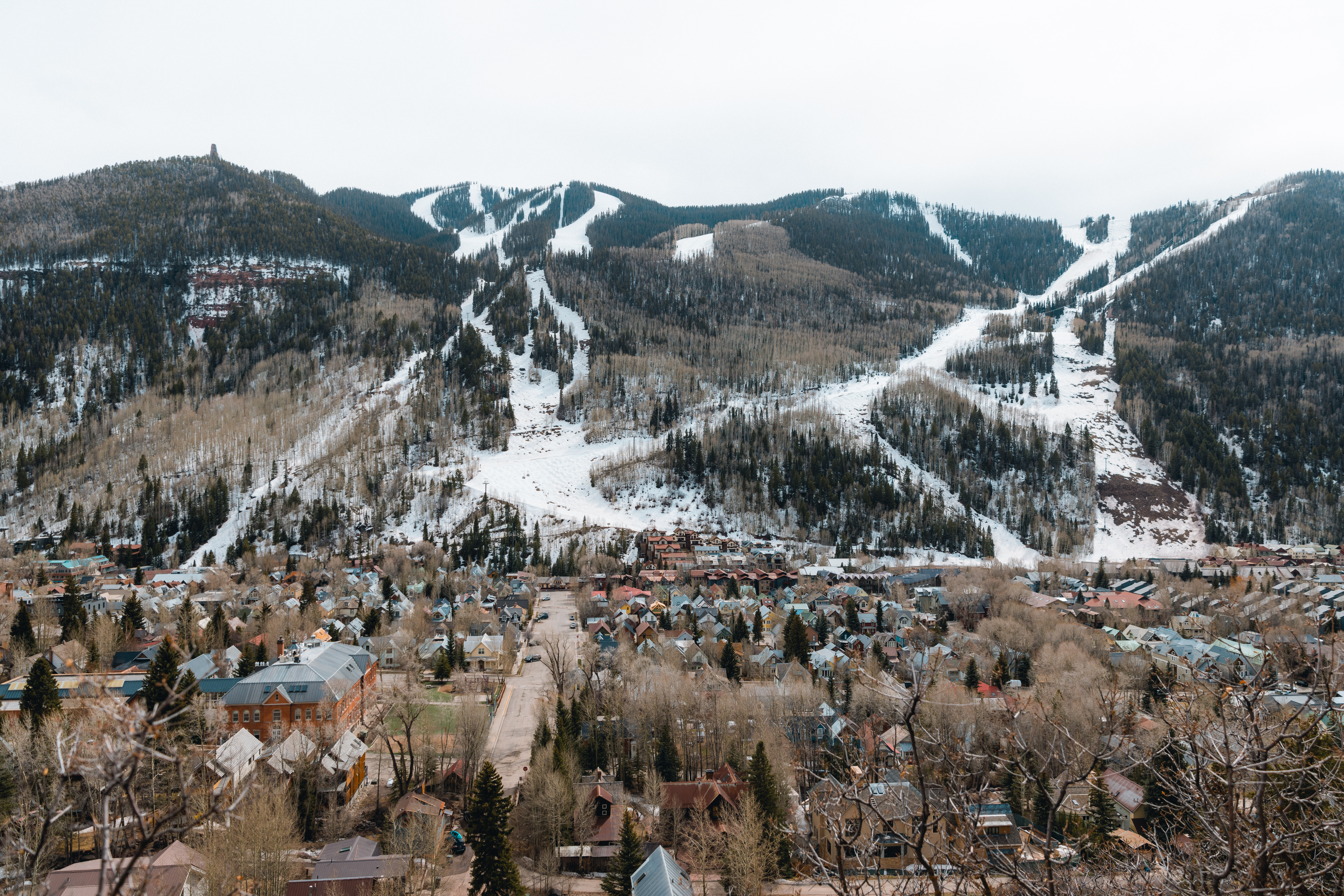
Telluride, Colorado is home to some of the best skiing in the world and of course some of the best hikes. During a visit during off-season Meagan and I hiked the Jud Wiebe Memorial Trail. This 3.1 mile loop trail starts in town and brings you to stunning views of Telluride.
The trail is quite steep taking you up 1,200 feet of altitude gain but the views from the top are worth it.
Table of contents
Jud Wiebe Trail Quick Facts
- Distance: about 3.1 miles (loop, some maps list up to 3.4)
- Elevation gain: around 1,200 feet
- Difficulty: moderate to hard
- Time: about 2 to 3 hours
- Trailhead: north end of Aspen Street in Telluride (no trailhead parking)
- Dogs: allowed, on leash
- Cost: free, no permit required
- Best time to hike: late spring through fall (aspens peak in late September)
Tips for Hiking Jud Wiebe Trail
Here are tips and things to know before doing the Jud Wiebe trail in Telluride.
- Plan about 2 hours to finish this hike.
- There is no parking at the trailhead so you’ll have to park in the neighborhoods near the trail head (should be plenty a couple of blocks away). Additionally the road to the trailhead is quite steep.
- The hike is fairly challenging with its 1,200 ft altitude gain but the incredible views are worth it.
- Bring water! On our trip we only brought one bottle of water for both of us and that was a mistake.
- Dogs are allowed and must be on leash.
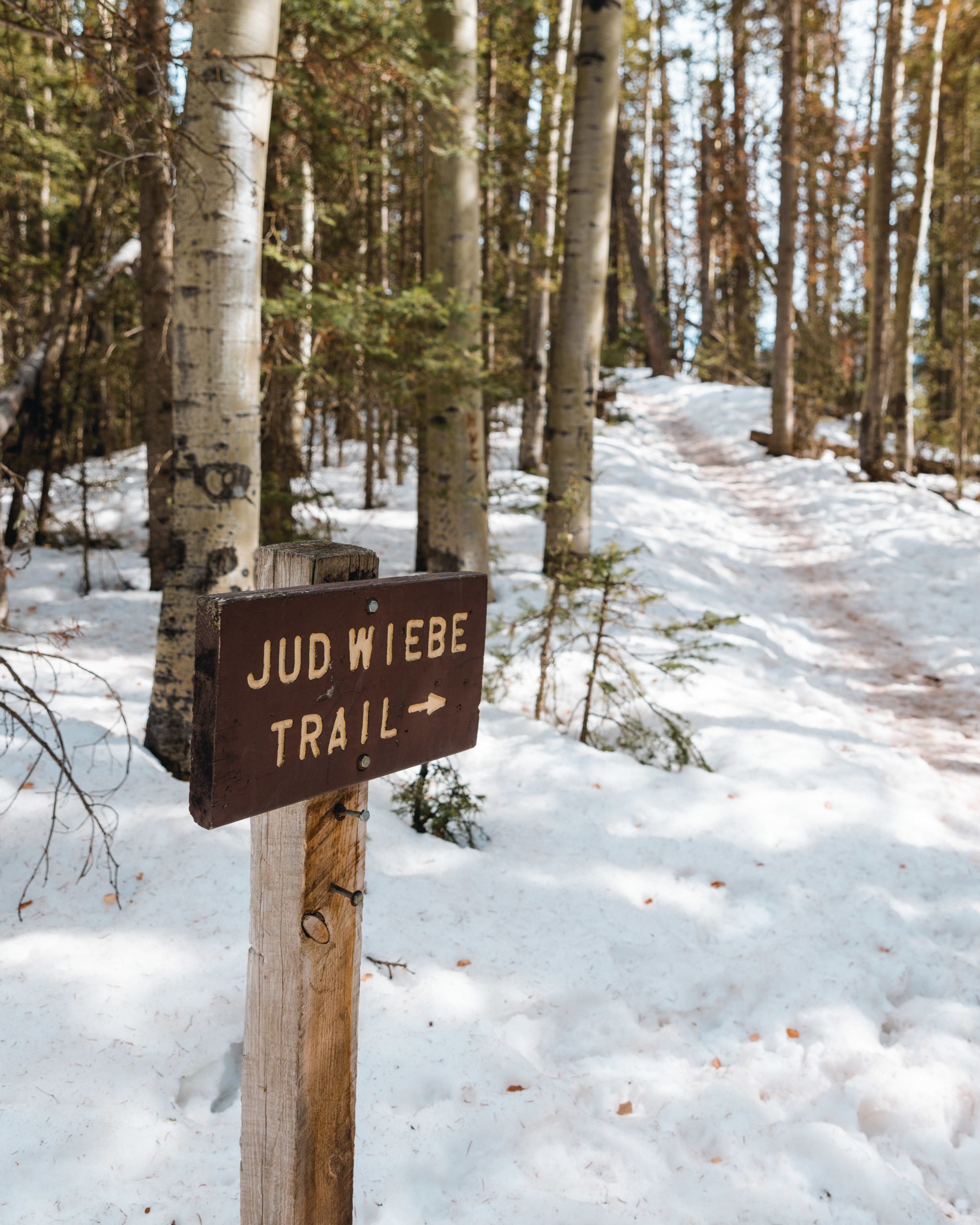
- You can start the hike at N Aspen St (this is where Google Maps lists the trailhead) or by walking up Liberty Bell Road. On our route we went from the N Aspen Street entrance and came out the Liberty Bell Road side.
Hiking the Jud Wiebe Memorial Trail
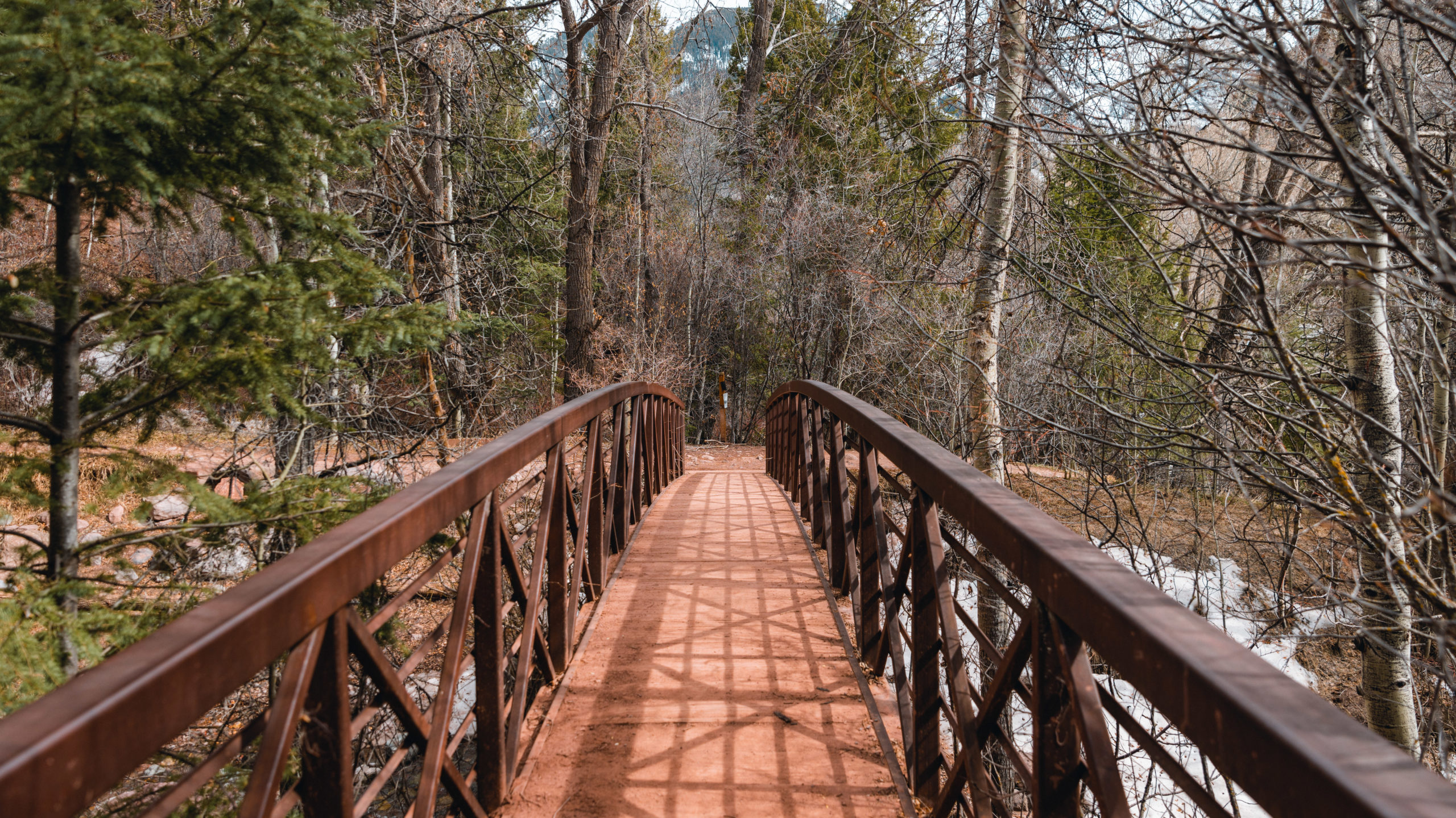
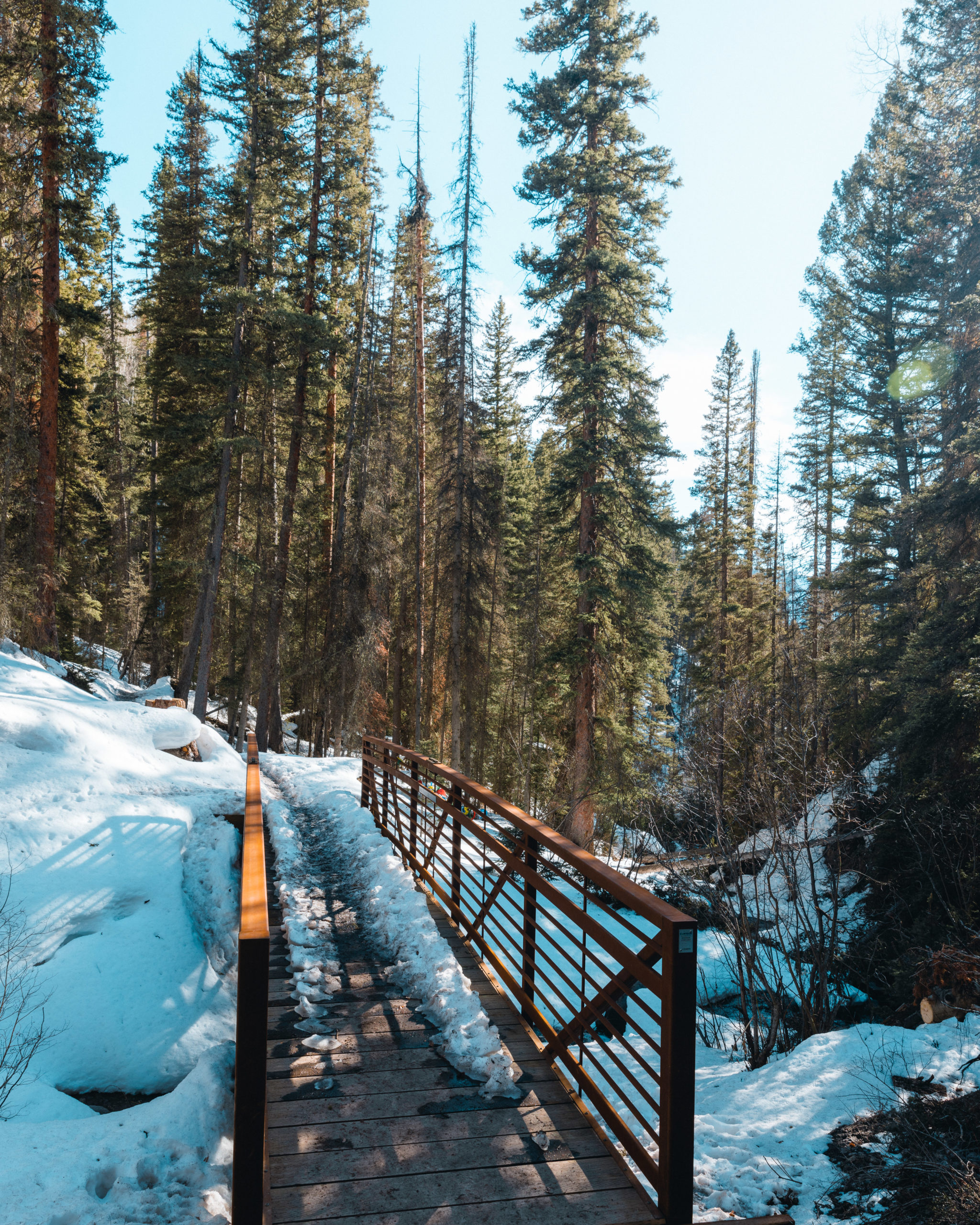
At the start of the hike from the trail head you’ll head west up the mountain crossing a bridge.
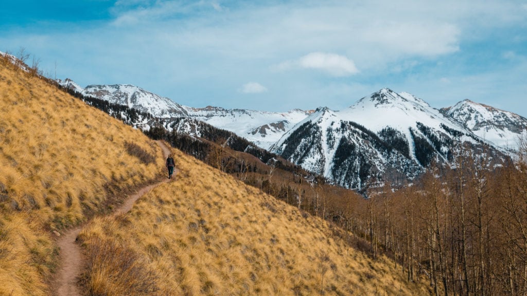
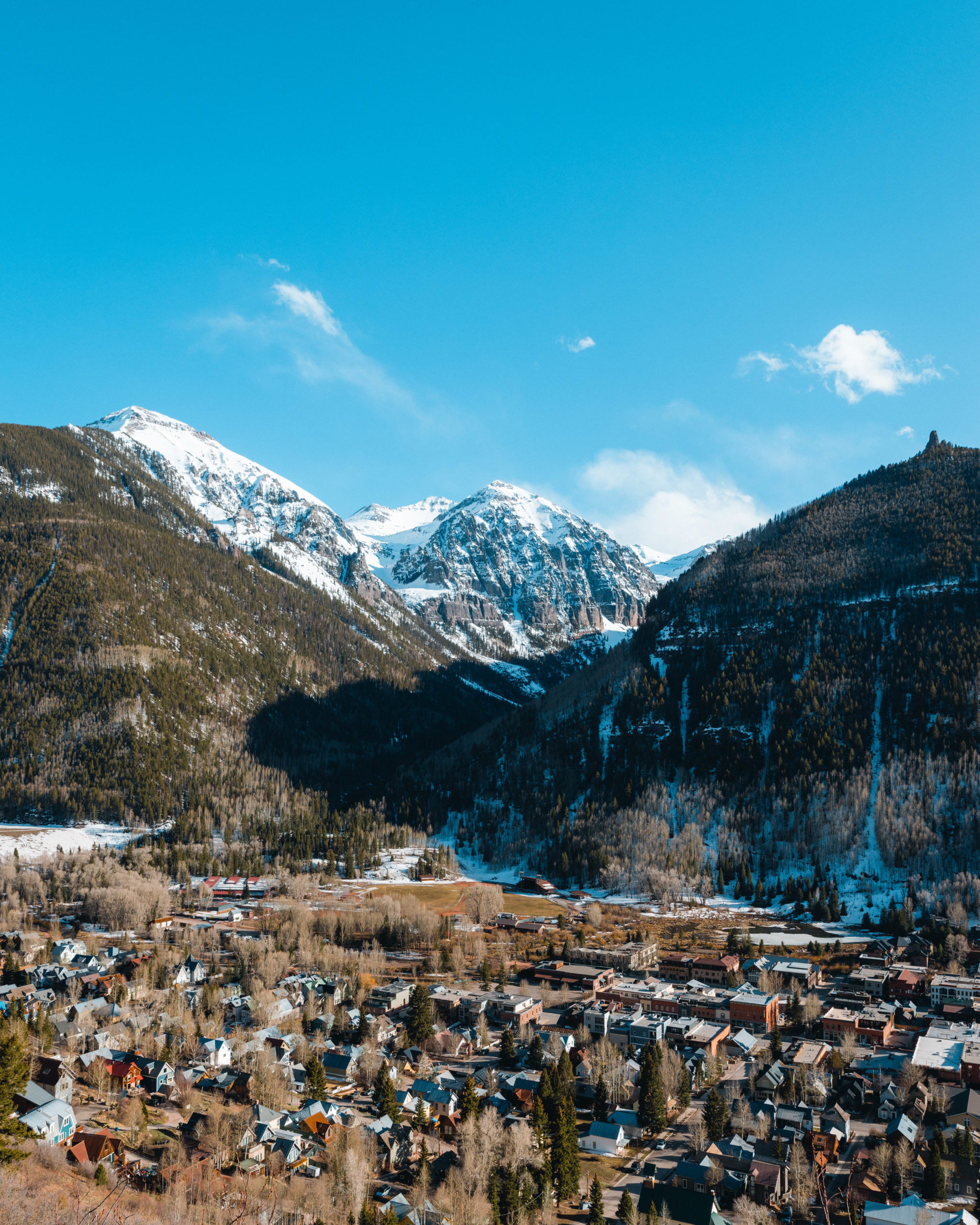
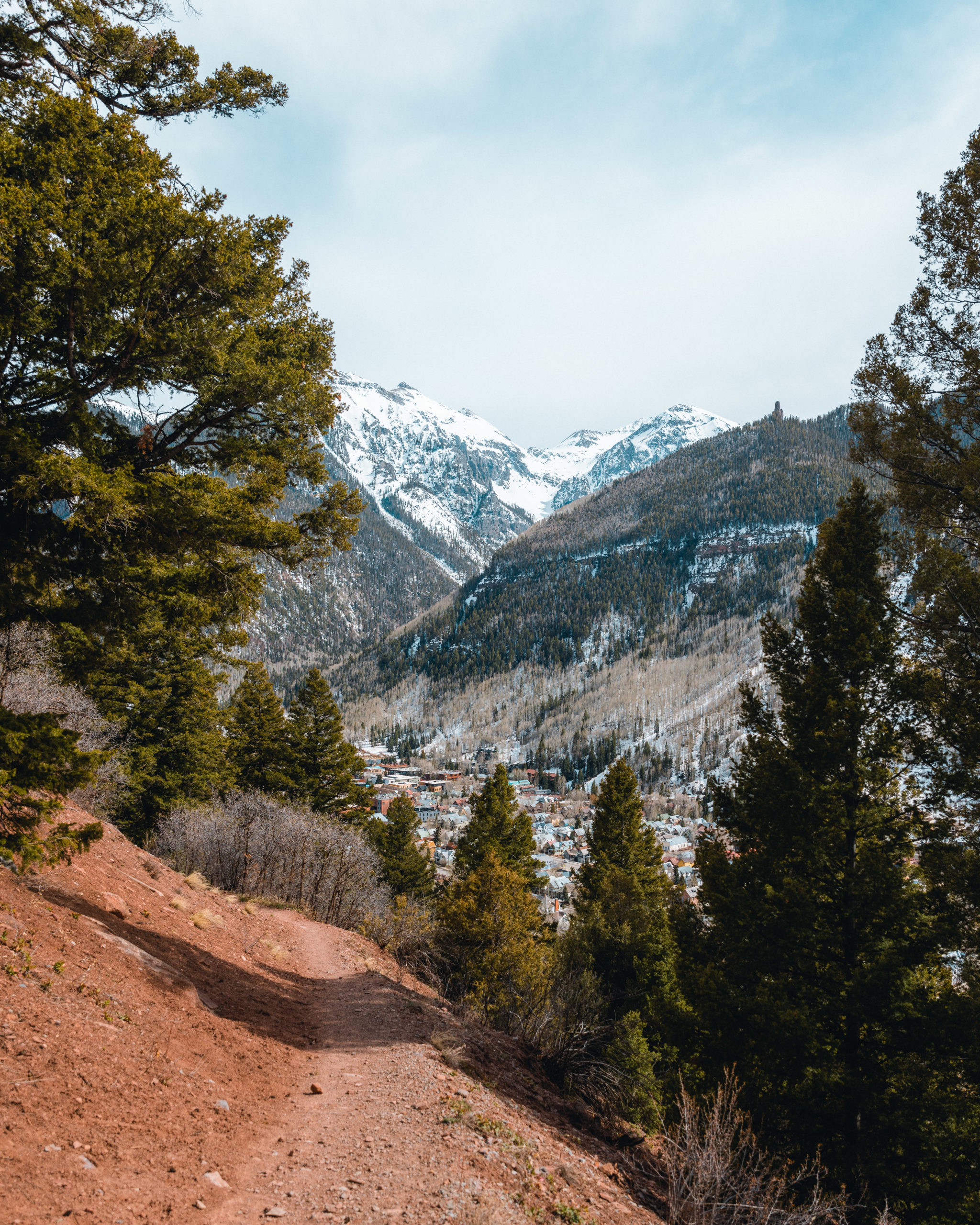
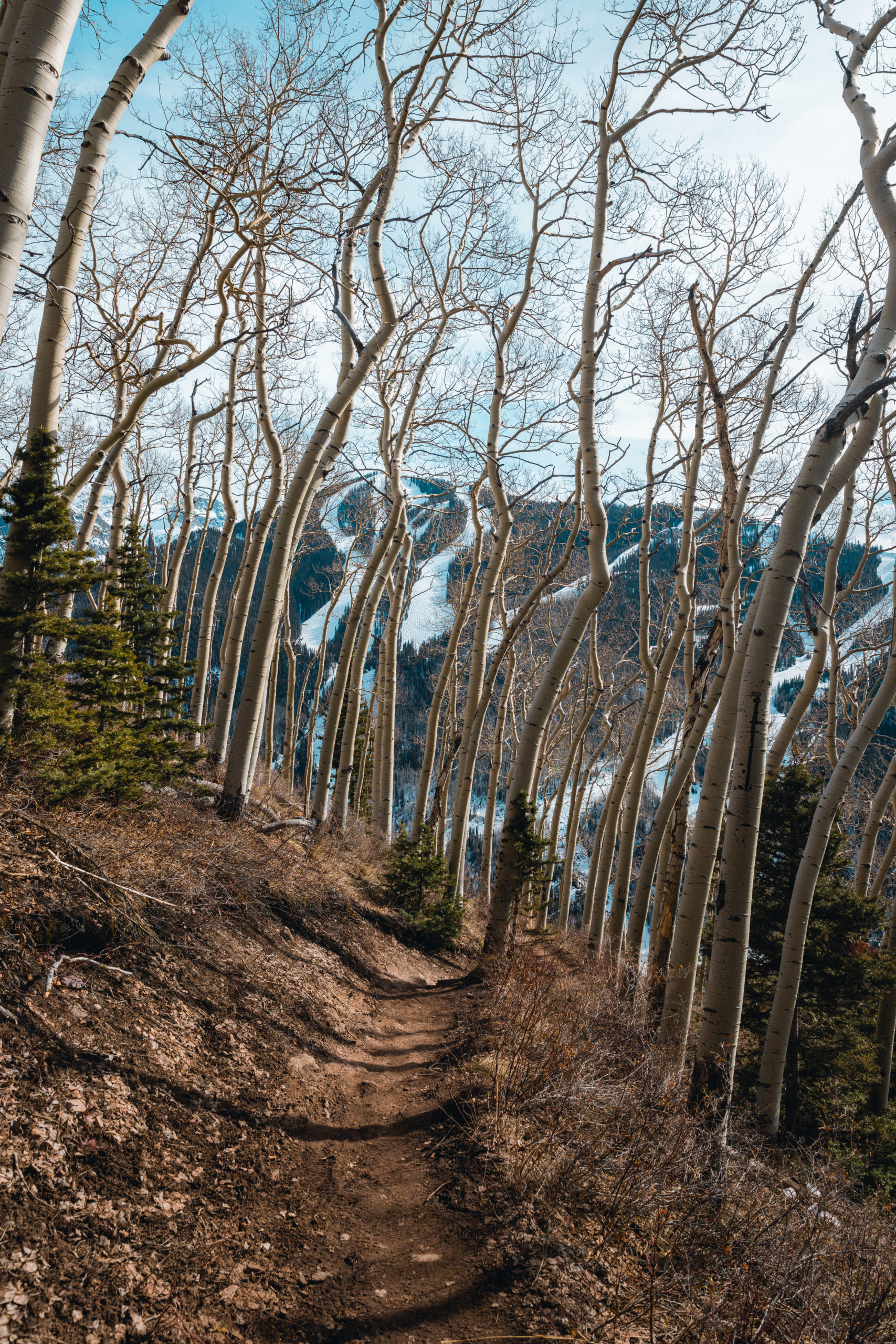
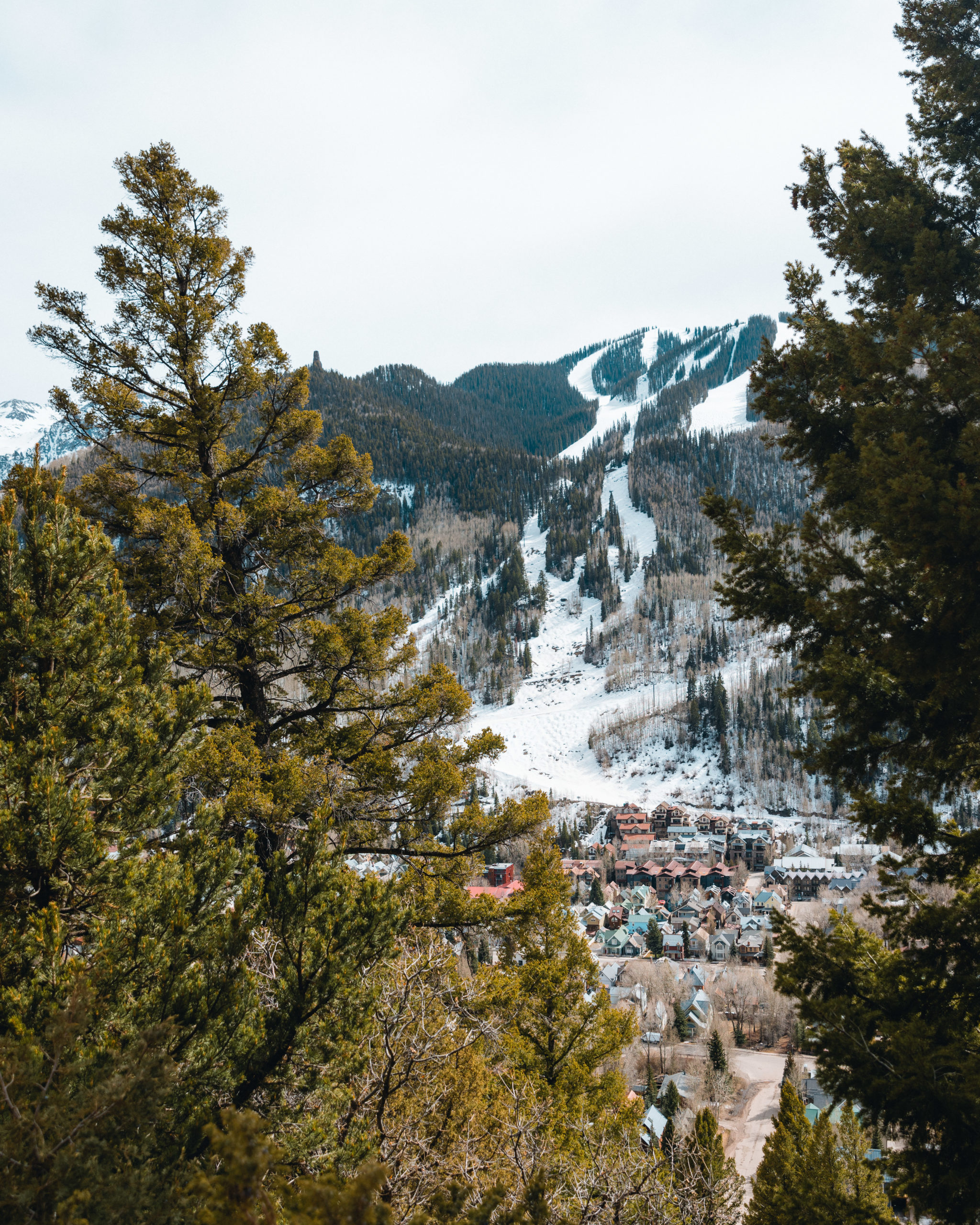
Fairly quickly you’ll start to see great views of Telluride. Since the road is so steep to the trailhead you’ll be fairly high at the start.
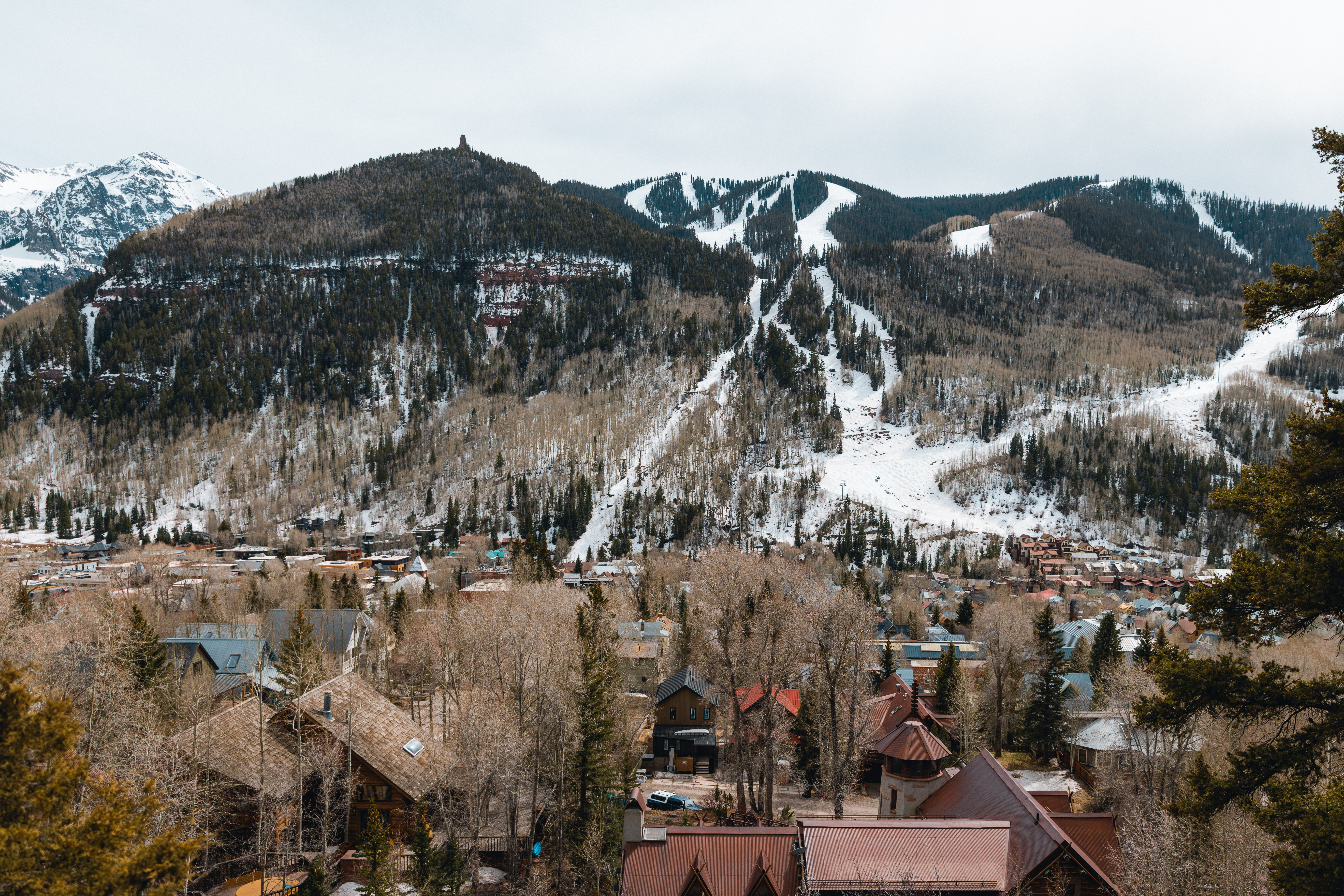
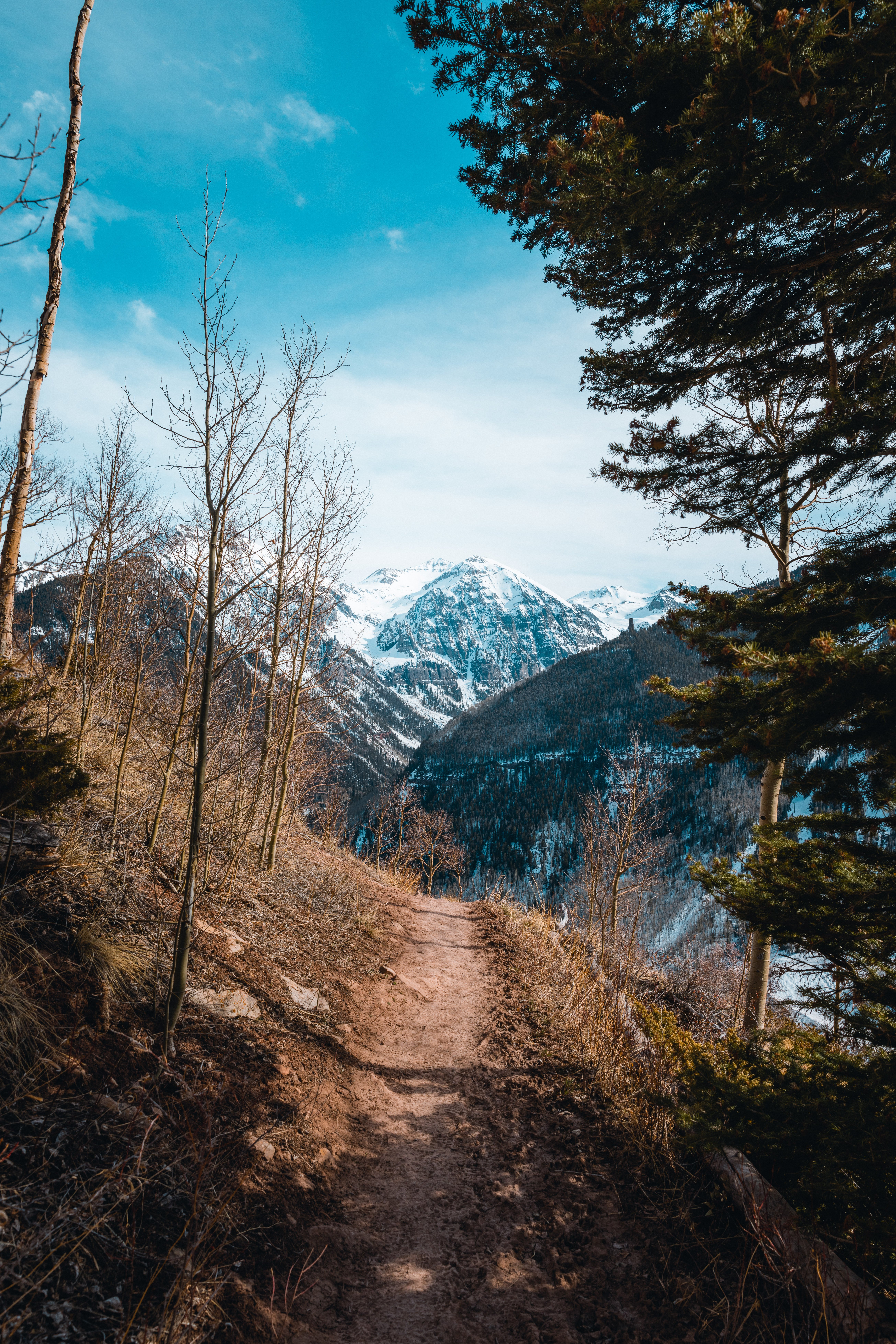
During the hike you’ll overlook Telluride, Mountain Village and the San Juan Mountains. It was hard not to stop every few minutes to capture the mountains through the trees as you ascend the mountain.
On our trip in April there were a few areas that had a couple of inches of snow. Mainly when we approached the first overlook 1 mile into the hike.
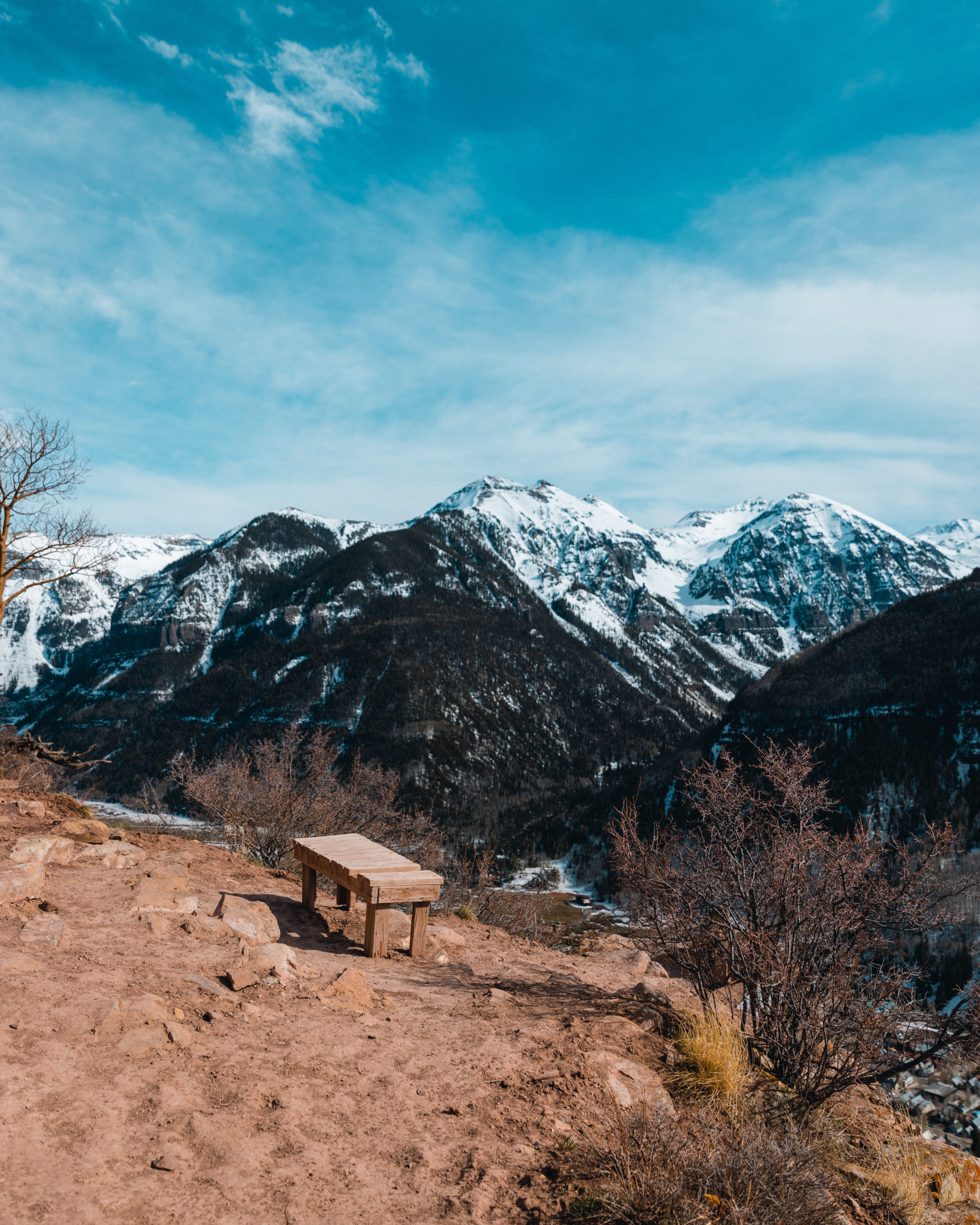
The trail has 2 overlooks, each having a bench to take a break while hiking.
The first overlook also included an info plaque about Jud Wiebe. Here is a summary of the plaque, Who is Jud Wiebe? Jud Wiebe was a U.S. Forest Service snow ranger in Norwood, Colorado. He designed, proposed, and began construction of this hike but sadly had an untimely death in 1986. This trail was completed a year later in 1987 by the Forest Service and volunteers. Jud’s vision was to create an easy recreational area in Telluride without needing to drive long distances.

The overlook of course had stunning views of Telluride and the surrounding mountains.

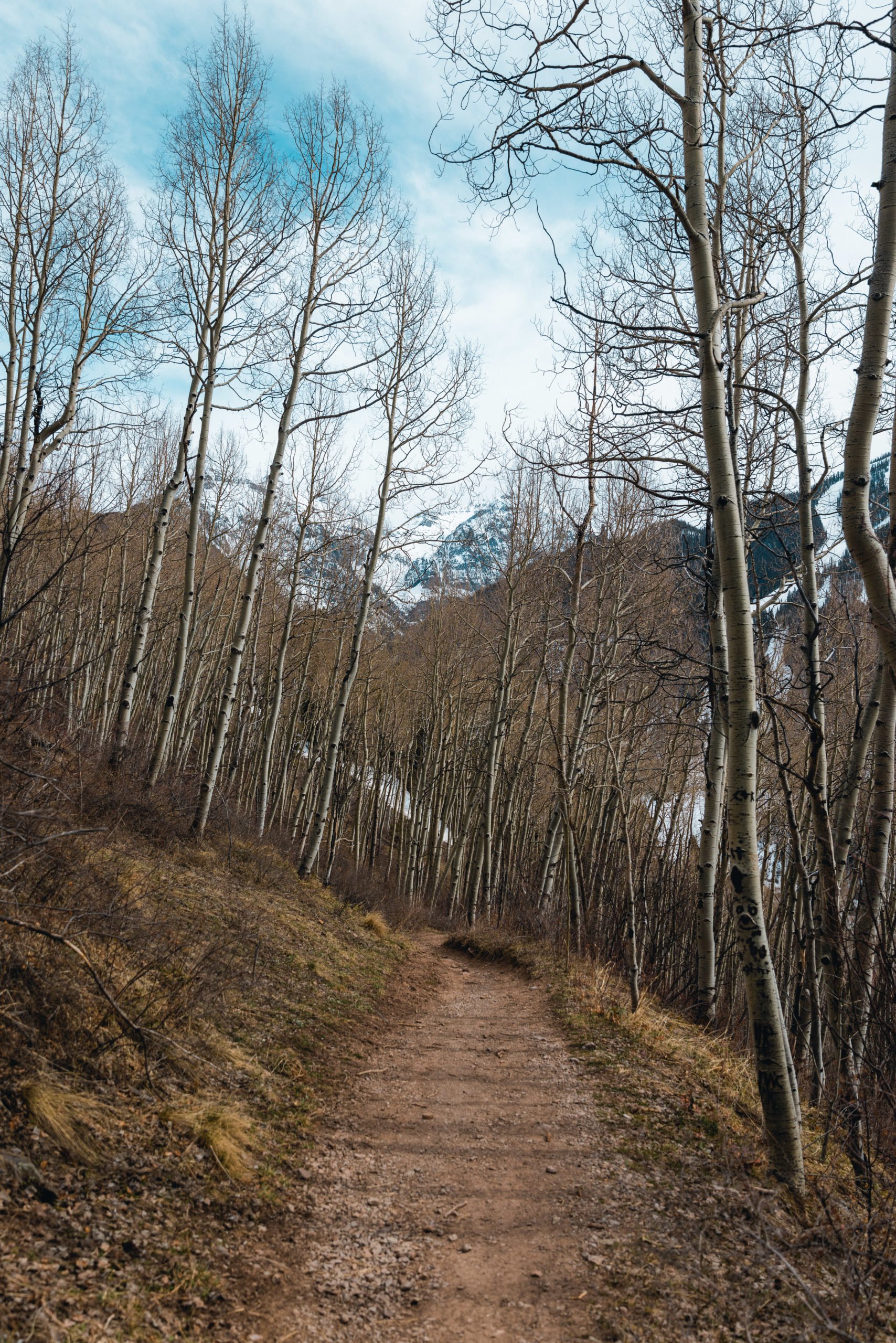
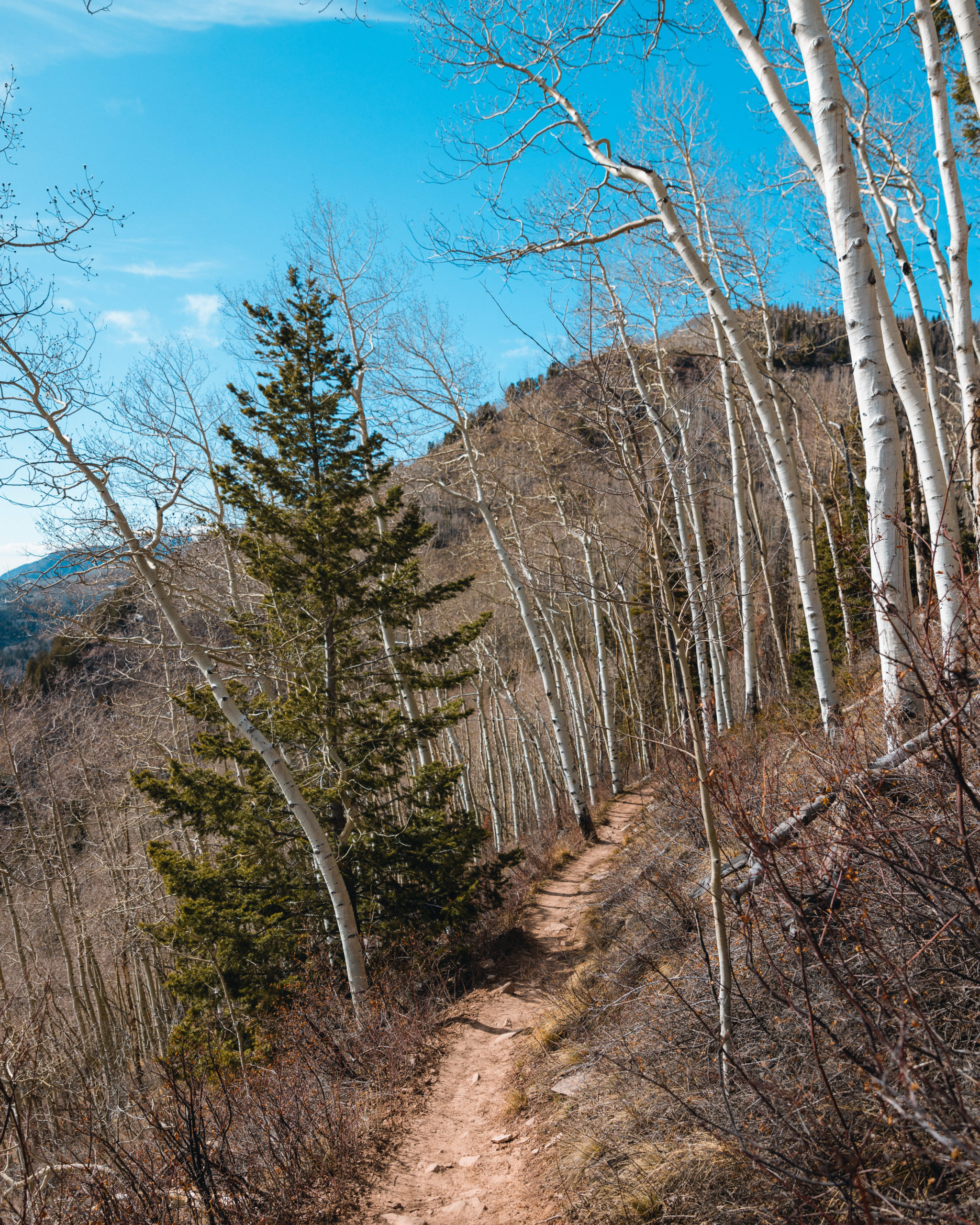
After stopping and enjoying the view there is still an ascent to the second overlook. You’ll start to head through aspens as you head up and I can tell this area would be stunning in fall.
My favorite part of the hike was before the second overlook where you get a stunning view of the San Juan mountains over this field with the trail going through it.
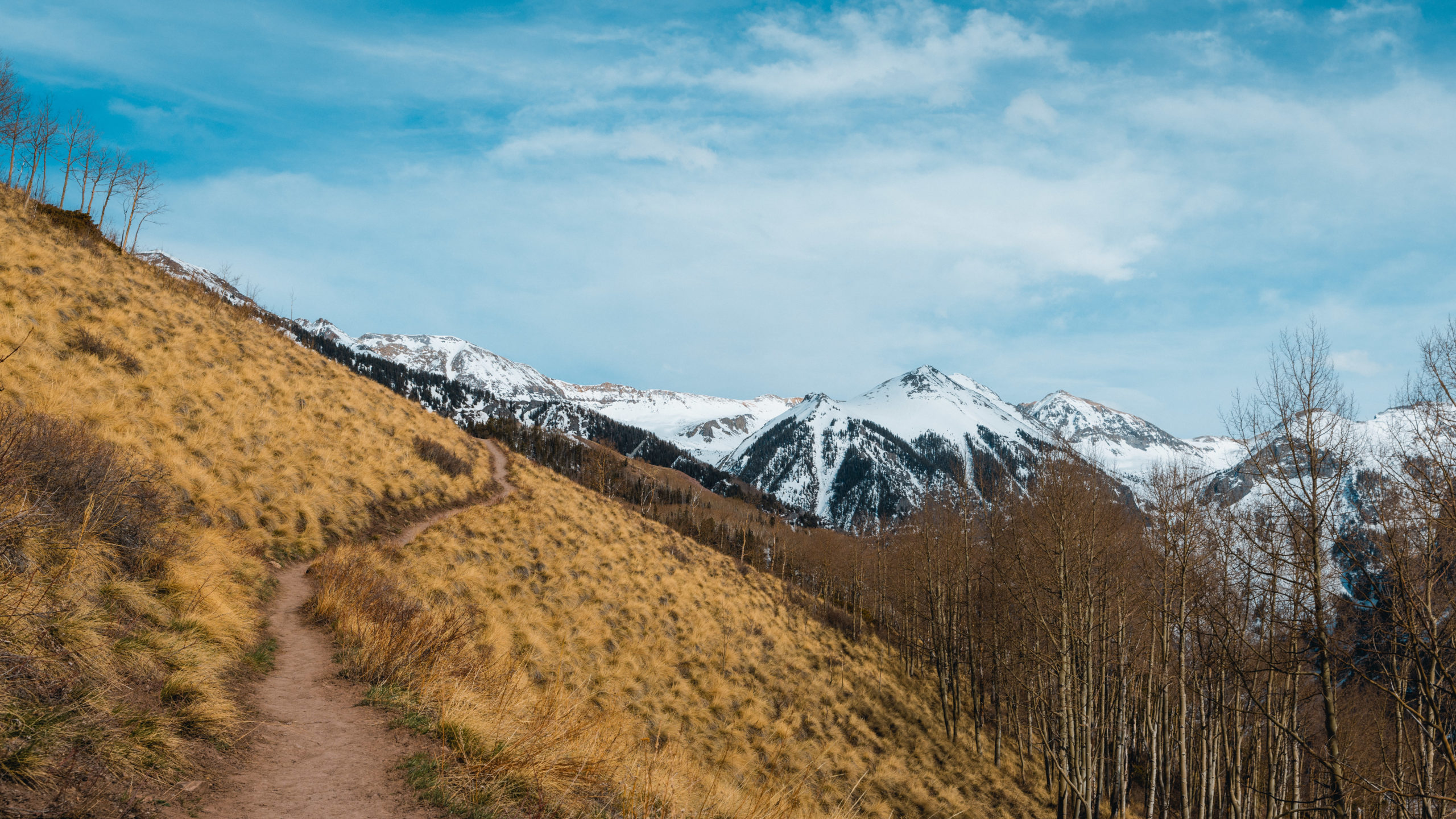
Here you’ll reach the second overlook and the peak of the trail. There is a bench with a back to it and panoramic views all around.
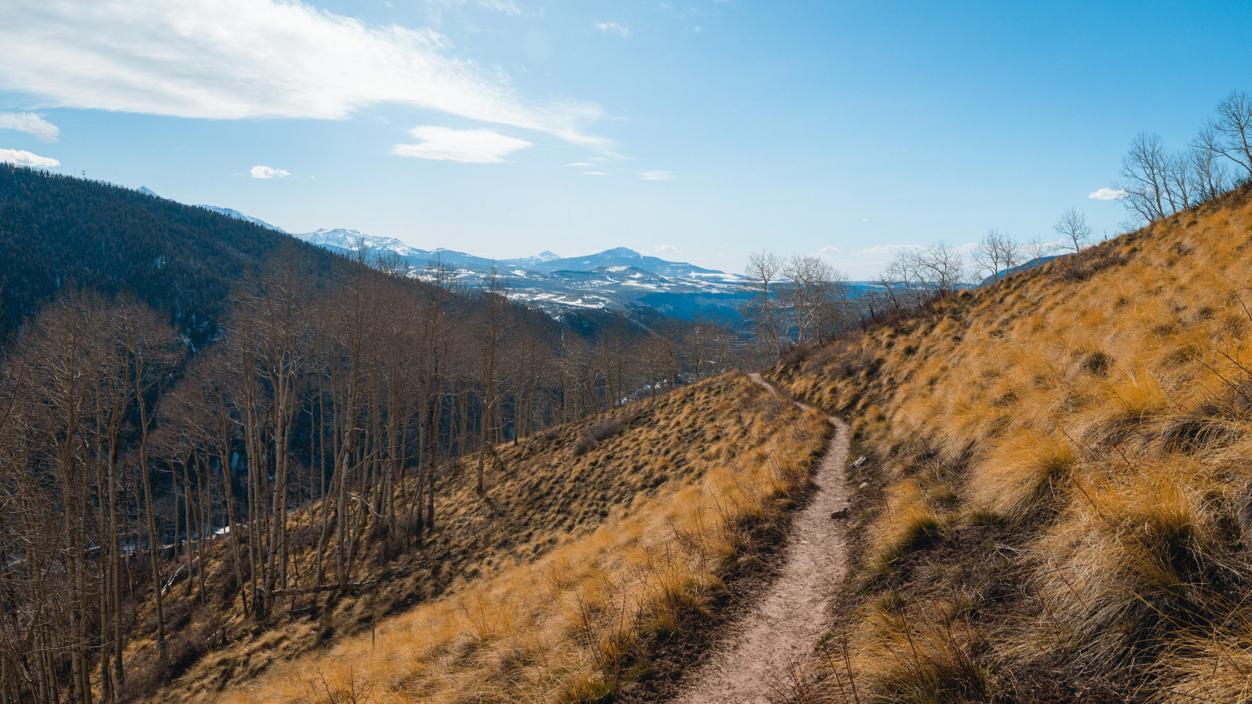
From here you’ll start your descent down the mountain. The hike down of course was much easier but there was still plenty to see.

As we headed down the mountain there were more areas with snow coverage. This part of the trail had more tree coverage and a bridge that crosses over a small stream.
Once you reach the end you’ll have to walk down Liberty Bell Road which is quite steep. This road connects to Tomboy Road which brings you back to town. The trail isn’t a full loop but at the end you’ll be a block away from the trailhead.
Jud Wiebe Trail Photos
Here are more pictures of the Jud Wiebe Trail in Telluride, Colorado. If you’re a photographer I’d recommend packing light since the altitude gain can be strenuous. For all of these photos I used a Canon 24-70mm on my Canon R5.
Want to improve your travel photography?
Read: Travel Photography Tips to Improve Your Photos


Jud Wiebe Trail FAQ
How long is the Jud Wiebe Trail?
The Jud Wiebe is about a 3.1-mile loop (some maps list it up to 3.4 miles). Most hikers finish it in 2 to 3 hours, depending on how often you stop for the views.
How hard is the Jud Wiebe Trail?
It’s a moderate-to-hard hike. The distance is short, but you climb around 1,200 feet, and Telluride’s 8,750-foot starting elevation makes the steep sections feel tougher if you aren’t acclimated. Bring plenty of water and take your time.
Where does the Jud Wiebe Trail start?
The main trailhead is at the north end of Aspen Street in Telluride, where it meets Tomboy Road. There’s no parking at the trailhead, so park a few blocks away in town and walk up.
Are dogs allowed on the Jud Wiebe Trail?
Yes, dogs are allowed but must be kept on a leash.
When is the best time to hike the Jud Wiebe Trail?
Summer and fall are ideal. The aspens turn gold in late September, making it one of the best fall-color hikes near Telluride. In early spring you may still hit snow on the upper sections of the trail.
Who was Jud Wiebe?
Jud Wiebe was a U.S. Forest Service ranger who planned the trail as an easy recreation loop right from town. He died in 1986 before it was finished, and the Forest Service and local volunteers completed it in his memory in 1987.
I hope you enjoyed my photos and guide to hiking the Jud Wiebe Memorial Trail. If you have any questions let me know in the comments below.
Enjoyed this article?
Save an image below to Pinterest