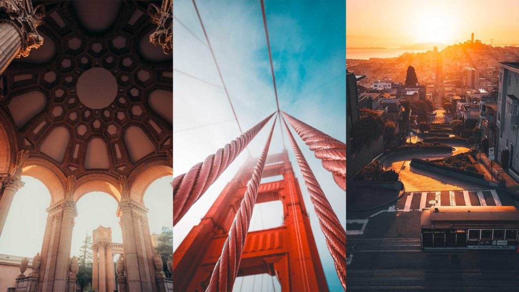
San Francisco has to be one of my favorite cities to photograph. The stunning hills, Golden Gate Bridge, and unique buildings make for a fantastic place to visit as a photographer. Whether you’re using a camera or taking photos on your iPhone there are unique perspectives all over San Francisco due to its unique layout.
I have been to San Francisco many times over the years so I figured I would share the best places to take pictures in San Francisco.
There is so much to do in this iconic city on the bay and hopefully these photo spots will jump start your trip.
Here is my list of the 20 best places to take photos in San Francisco:
- 1. Golden Gate Bridge
- 2. Slacker Hill
- 3. Palace of Fine Arts
- 4. Pier 7
- 5. Pier 39
- 6. Baker Beach
- 7. Coit Tower
- 8. Golden Gate Overlook
- 9. Lombard Street
- 10. Alamo Square Park & The Painted Ladies
- 11. Dolores Park
- 12. Twin Peaks
- 13. San Francisco’s Chinatown
- 14. Alcatraz Island
- 15. Treasure Island
- 16. Cupid’s Span
- 17. Sutro Baths
- 18. SF-Oakland Bay Bridge
- 19. The Ferry Building
- 20. San Francisco from the Sky
1. Golden Gate Bridge
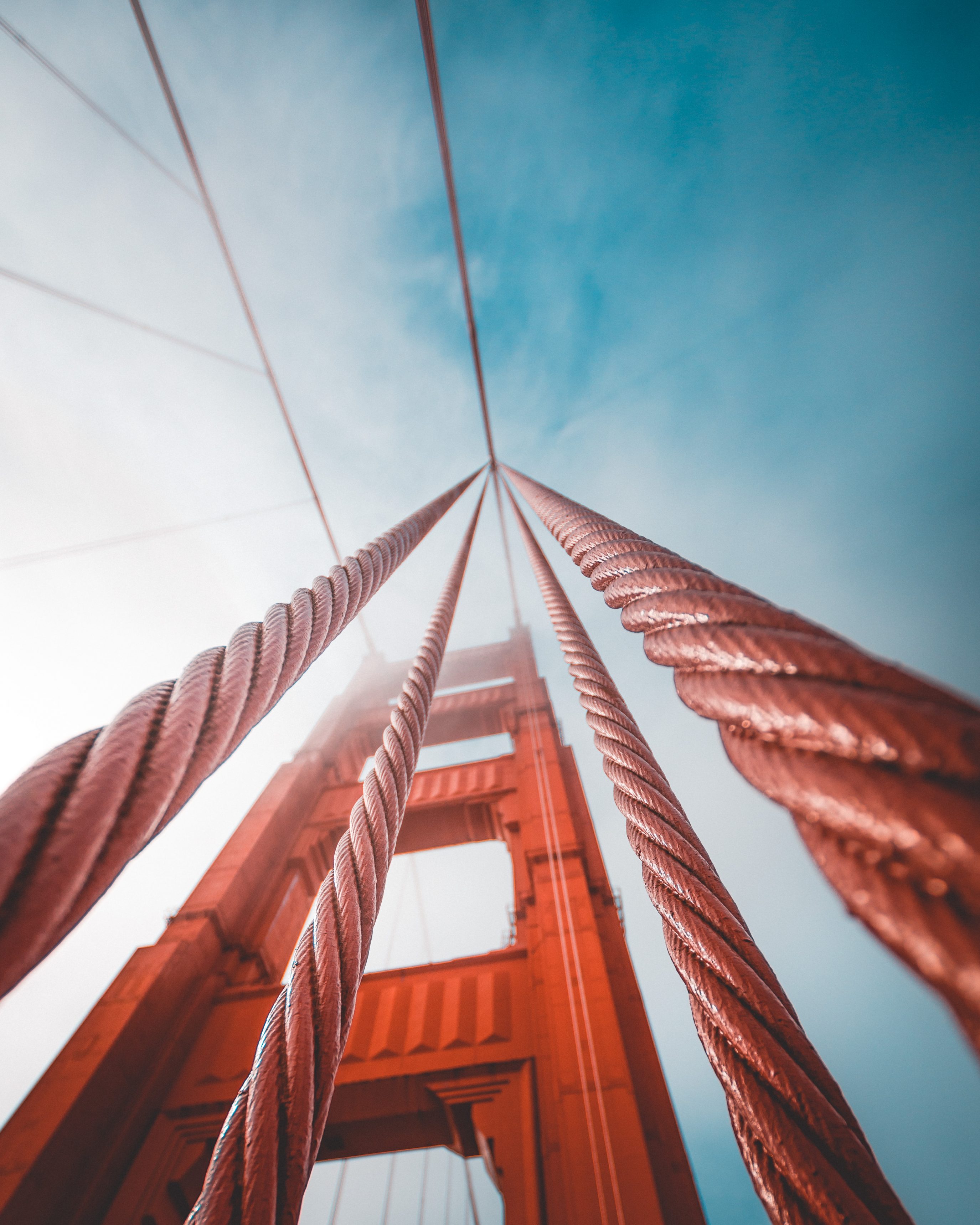
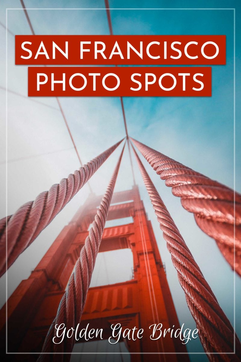
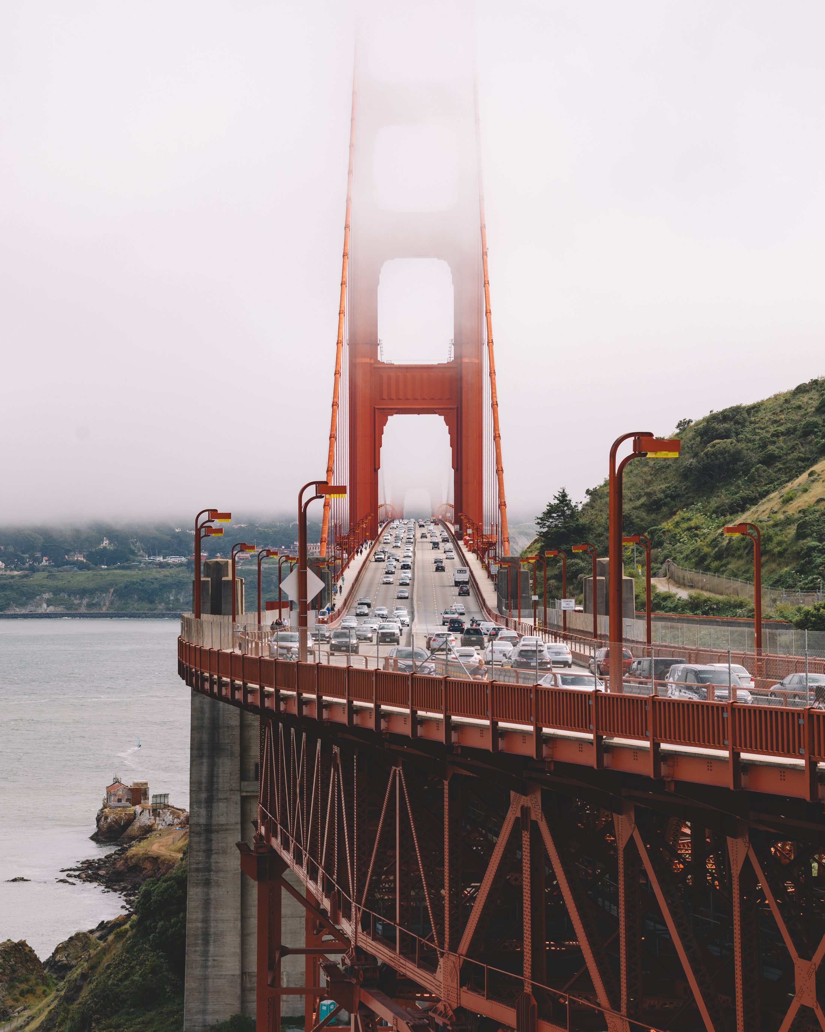
The most iconic symbol of San Francisco has to be the Golden Gate Bridge. This 1.7-mile suspension bridge with its iconic International Orange color is hard to miss, and the east sidewalk (open to pedestrians sunrise to sunset) gets you eye-level with the suspension cables. A wide-angle lens captures the full span; a 70-200mm compresses the cables into the dramatic geometric shots you see all over Instagram. Fog rolls in most heavily June through August, so plan around that depending on whether you want clear shots or moody ones.
2. Slacker Hill
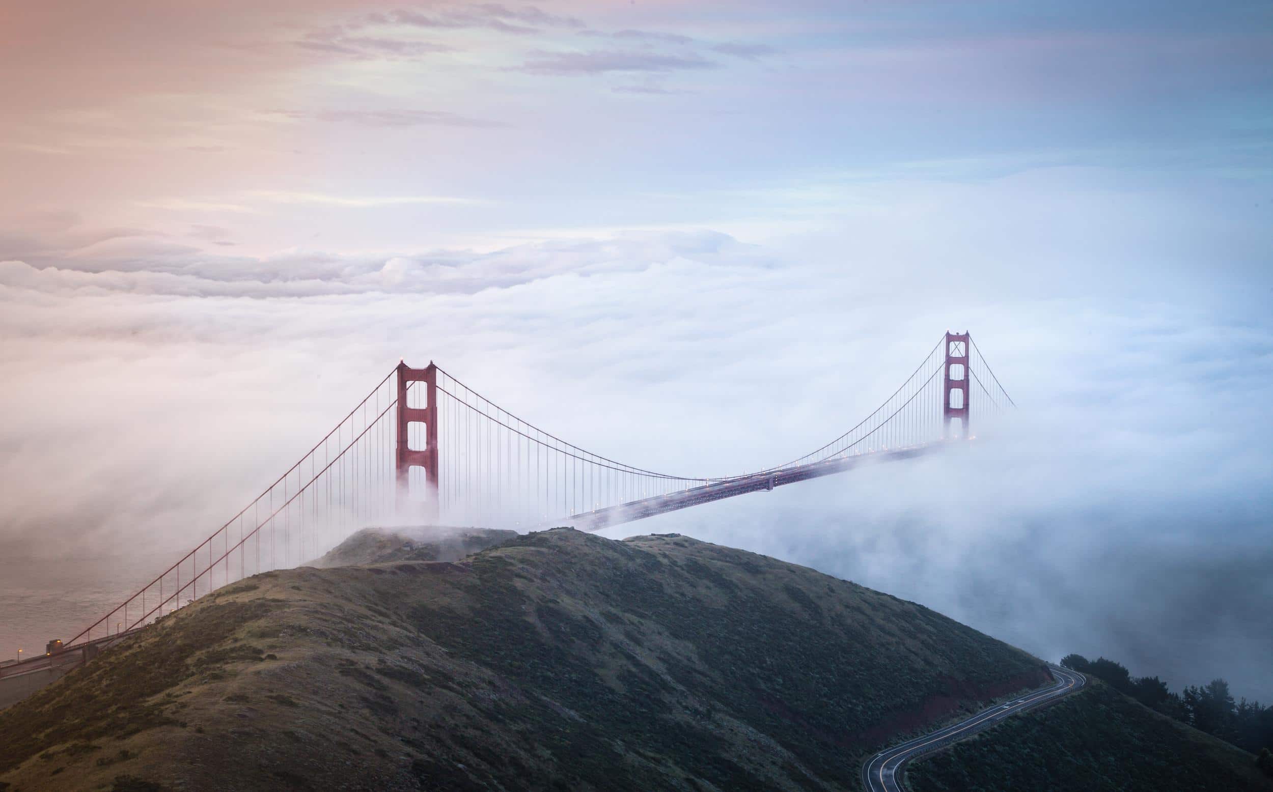
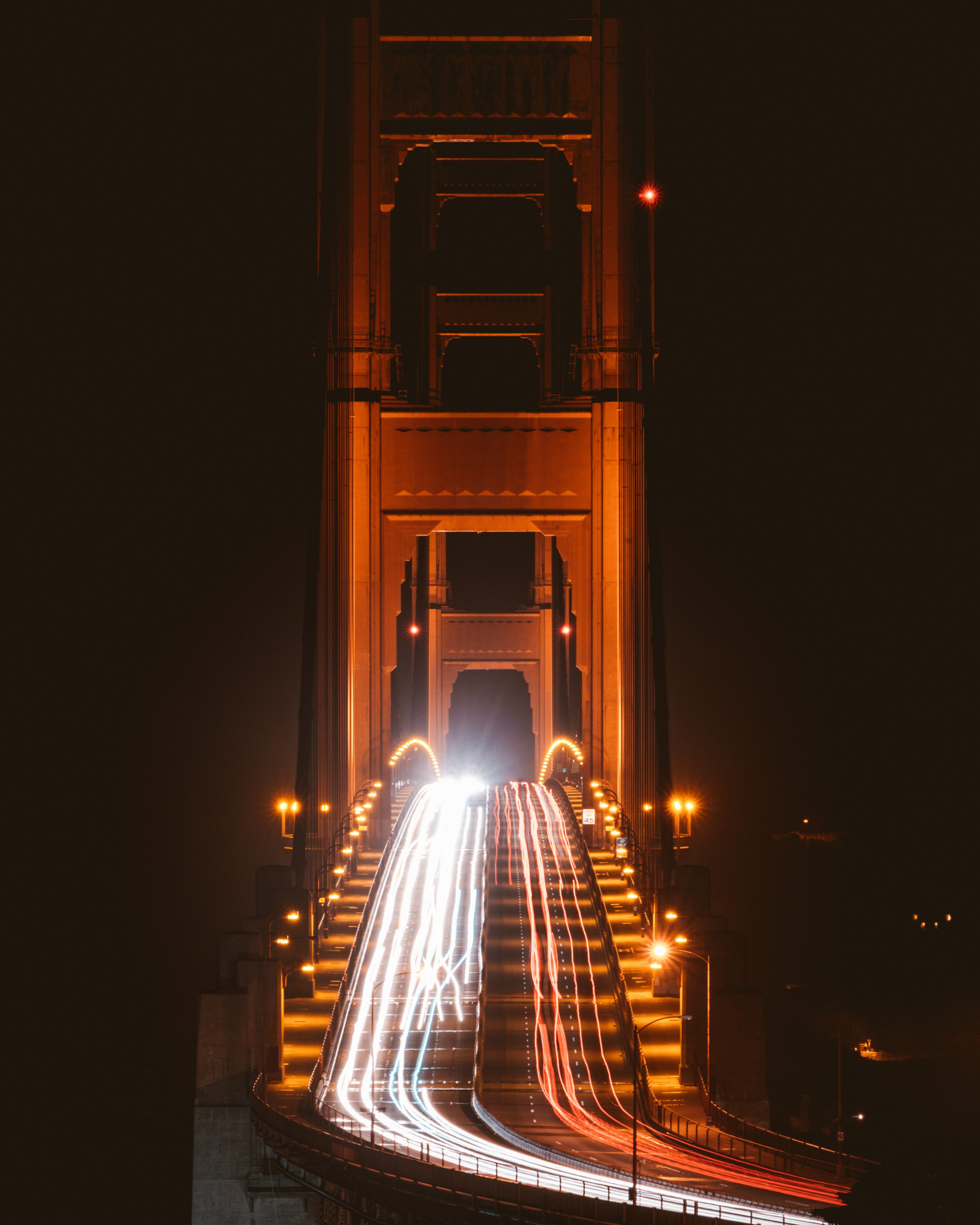
Slacker Hill is a fantastic place to watch sunrise over San Francisco. Park at the Spencer Battery lot in the Marin Headlands, then hike about a half mile up the SCA trail to the summit. The elevated angle puts the bridge below you with the city skyline behind, and you’ll likely see Karl the fog flowing through the bridge towers if you time it right. Bring a jacket, the wind whips up there.
Slacker Hill on Google Maps3. Palace of Fine Arts
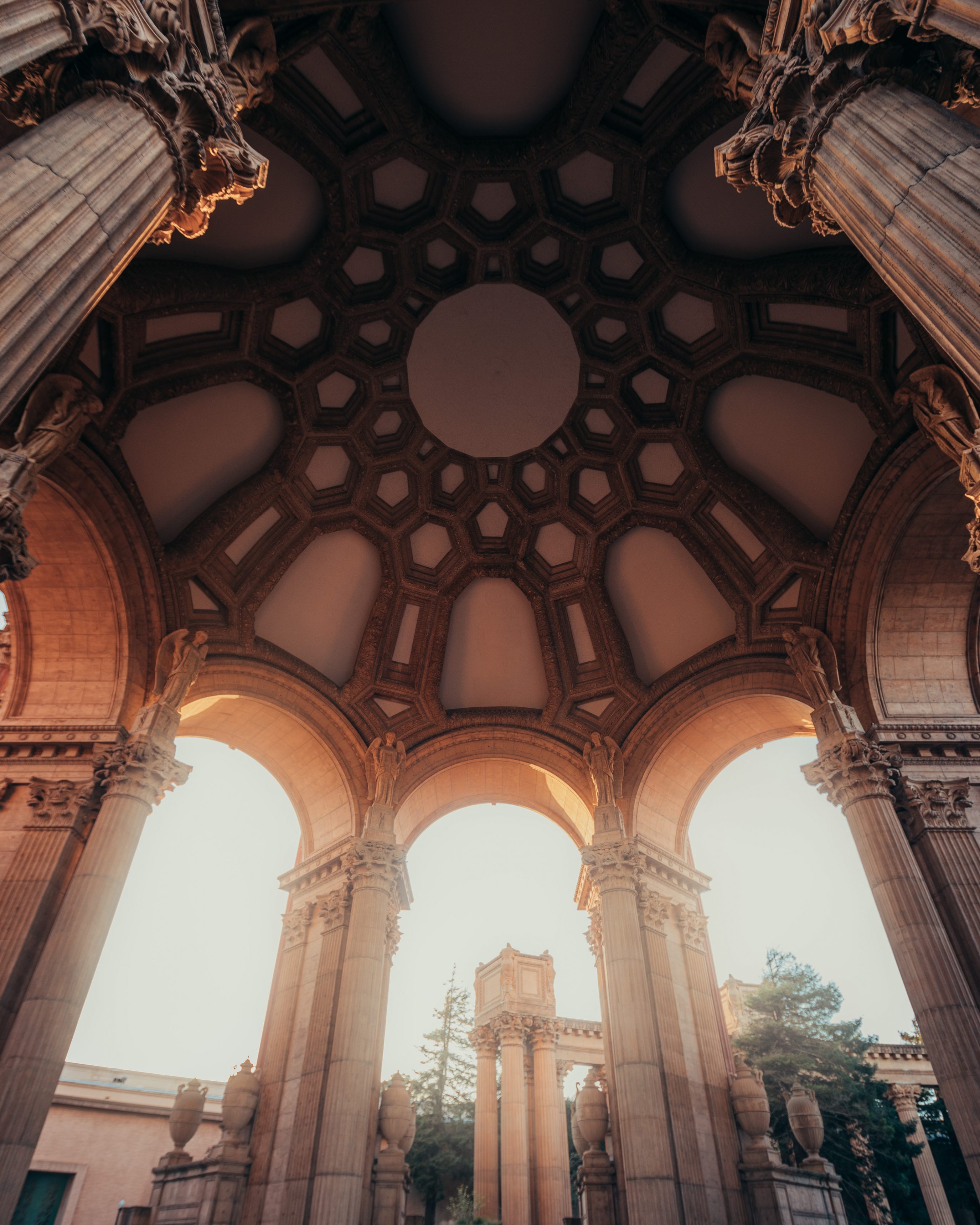
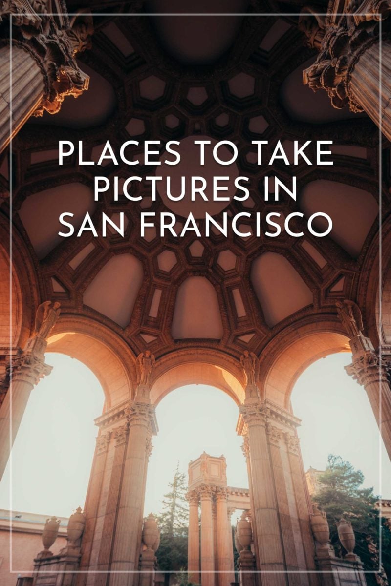
This Roman-styled dome looks fantastic at golden hour. The Palace of Fine Arts was built for the 1915 Panama-Pacific International Exposition and rebuilt in concrete in the 1960s. The lagoon out front gives you a perfect reflection shot on a still morning, and the colonnades behind the rotunda are popular for engagement and wedding sessions. Parking is free along the surrounding streets, but it fills up fast on weekends.
Palace of Fine Arts on Google Maps4. Pier 7
Pier 7 offers fantastic views of the Bay Bridge and the SF city skyline. Located right downtown, you can line up the pier with the Transamerica Pyramid for a textbook leading-lines shot. The pier is also lined with antique-style street lamps that look great for night photography. Blue hour about 30 minutes after sunset gives you the best mix of sky color and lit lamps. It’s also popular to frame the wooden benches’ circular arms against the bridge.
Pier 7 on Google Maps5. Pier 39
Sea lions! Pier 39 is known for the California sea lions (not seals) that haul out on the K-Dock wooden floats. Population peaks in winter and early spring, so head down before 10am for the most active scene before they head out to feed. A 70-200mm lens lets you get tight portraits without disturbing them. The pier itself also has great views back toward the SF skyline and Coit Tower.
Pier 39 on Google Maps6. Baker Beach
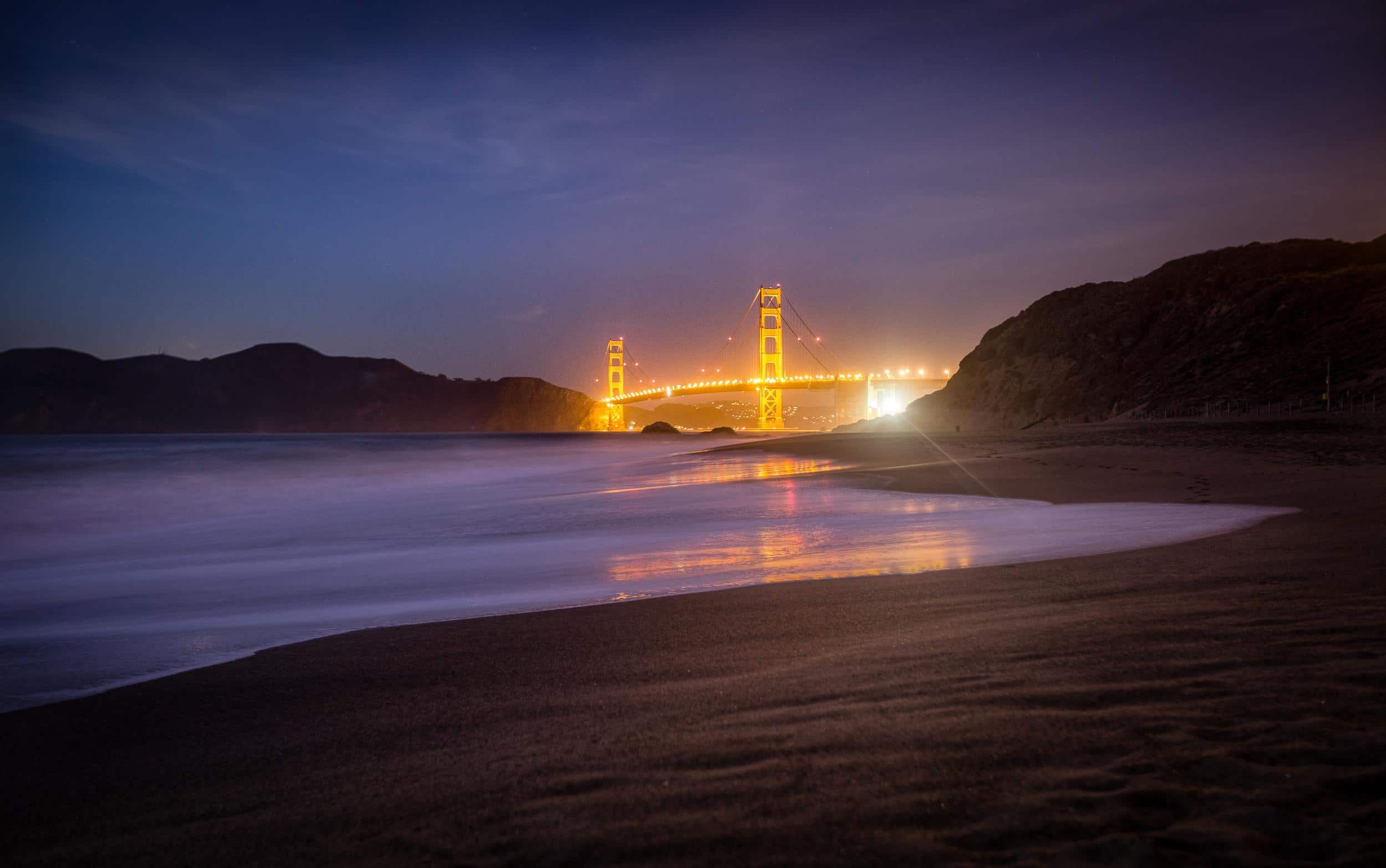
If you love photographing water Baker Beach offers incredible views of the Golden Gate Bridge. Make sure to bring a coat since it’s usually chilly on the beach at night. On a sunny day it can also be hard to find a spot in the parking lot so prepare accordingly.
Note: Most of Baker Beach is a nude beach so don’t be surprised if you see nude people sunbathing on a nice day here. I don’t recommend using your camera if nudists are there since it’ll make people uncomfortable. Luckily it’s typically empty at night.
Baker Beach on Google Maps7. Coit Tower
Coit Tower overlooks San Francisco with a 360-degree view from its 210-foot tower atop Telegraph Hill. You can buy tickets to ride the elevator to the observation deck for even better skyline views, though the base of the tower is free to visit and arguably gives you the more photogenic vantage point of the city below.
Completed in 1933, the Art Deco tower was funded by socialite Lillie Hitchcock Coit’s bequest to beautify San Francisco and designed by Arthur Brown Jr. (the architect behind City Hall). Inside, the ground floor is wrapped in 1934 PWAP-era fresco murals depicting Depression-era California life. The often-repeated “fire hose nozzle” resemblance is a coincidence; Brown himself denied the design was inspired by it.
For an extra bit of exercise, walk down the Filbert or Greenwich Steps on the east side of the hill. They wind through wooden cottage gardens and frame the Bay Bridge perfectly.
Coit Tower on Google Maps8. Golden Gate Overlook
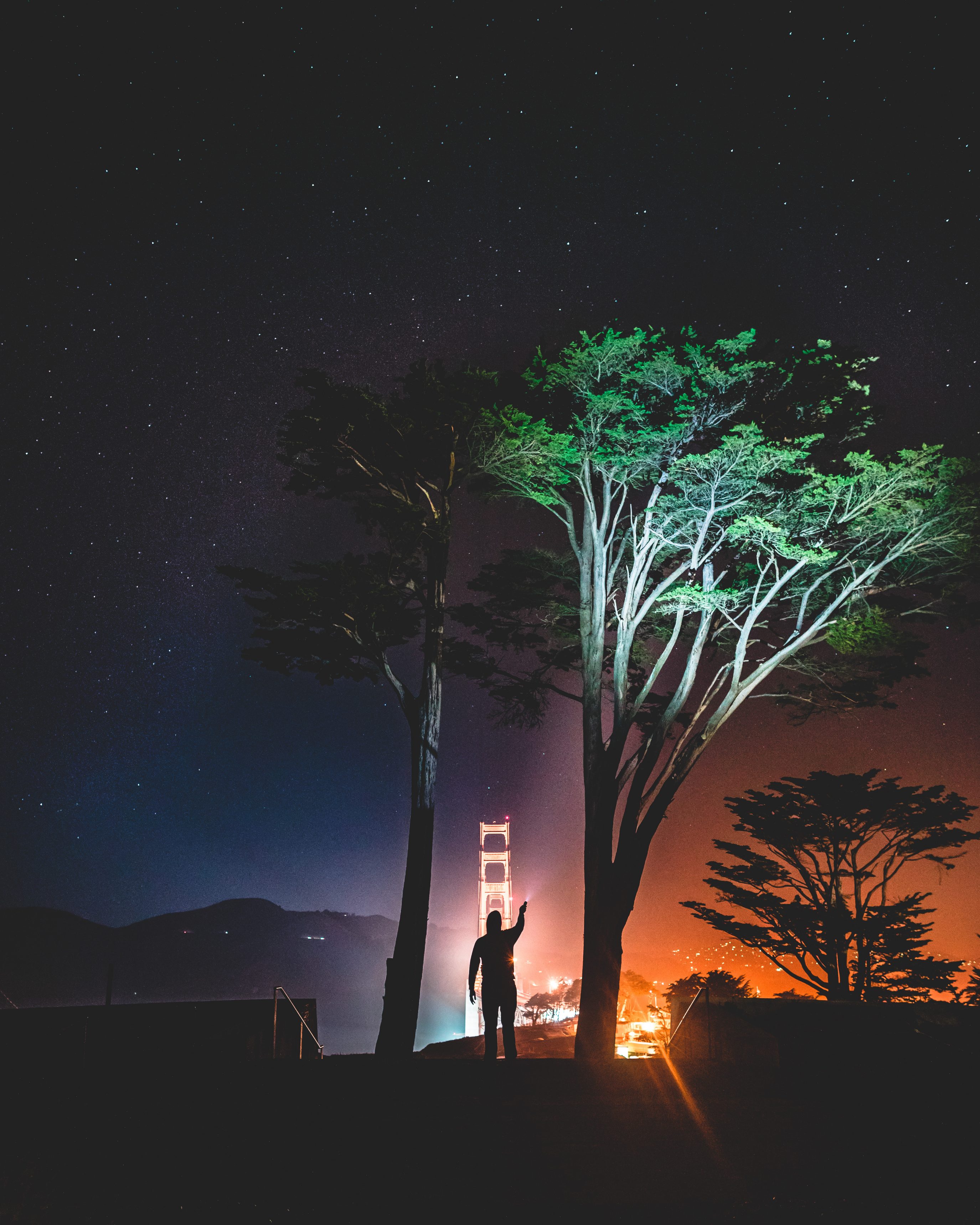
Golden Gate Overlook sits on the south side of the bridge inside the Presidio and gives you a clean, direct view of the towers without the climb to Slacker Hill or Battery Spencer on the Marin side. You can also watch the famous moveable median barrier (the “zipper truck”) reconfigure lanes during commute hours.
If you want the classic high-angle Marin Headlands shot, Battery Spencer (just across the bridge) is the postcard view. Both spots are inside the Golden Gate National Recreation Area, with free parking, old gun batteries to explore, and trails along the cliffs.
Golden Gate Overlook on Google Maps9. Lombard Street
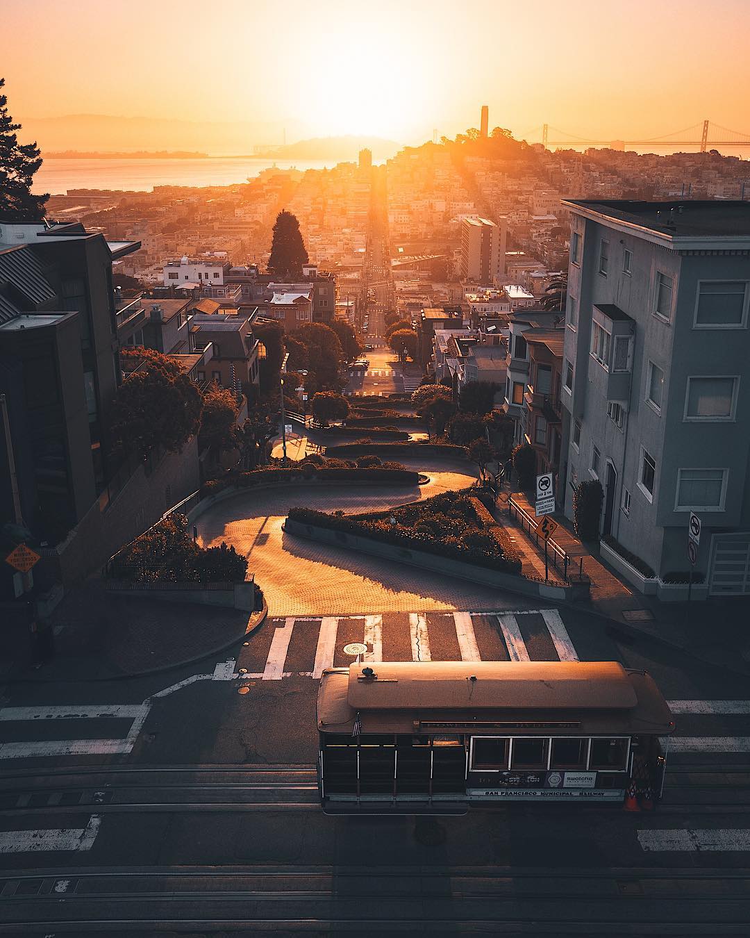
San Francisco’s curvy road is known by many and hard to miss. Lombard Street‘s eight tight switchbacks were built in 1922 to tame a 27-degree natural grade. If you have a rental car, drive down. It’s one-way going downhill only. A telephoto from across the hill compresses the curves into the classic stacked-hairpins shot, while standing at the base looking up gives you the foreshortened “wall of flowers” angle. Reservation and toll systems have been proposed but never passed, so as of 2026 it’s still free to drive.
Lombard Street on Google Maps10. Alamo Square Park & The Painted Ladies
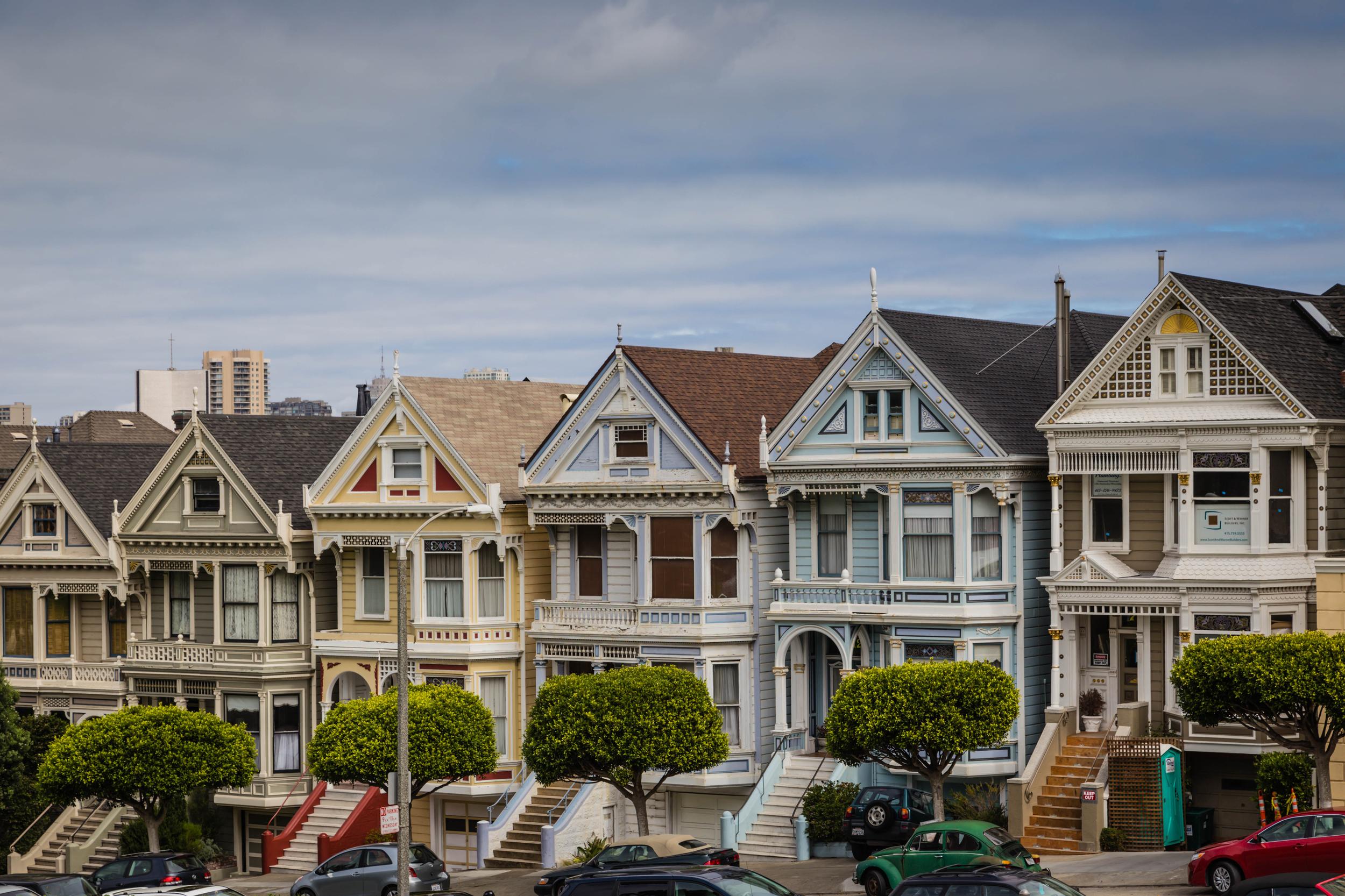
Heavily featured in the Full House intro, Alamo Square Park is home to the famous Painted Ladies, a row of Victorian houses on Steiner Street known as “Postcard Row.” The classic angle is from the bench area on the east side of the park, where the Victorians line up against the downtown skyline including the Salesforce Tower. Late afternoon light hits the facades head-on, but golden hour from the southeast corner is when the colors really pop.
Alamo Square Park on Google Maps11. Dolores Park
If you want to soak up some sun and views of the city, Dolores Park is a great place to relax during the day. The northwest corner, locally called “Hipster Hill,” gives you palm trees in the foreground with downtown stacked behind. When you visit, stop by Tartine Bakery a few blocks away for a morning bun and Bi-Rite Creamery for ice cream. The J Church MUNI line drops you right at the park’s edge.
Dolores Park on Google Maps12. Twin Peaks
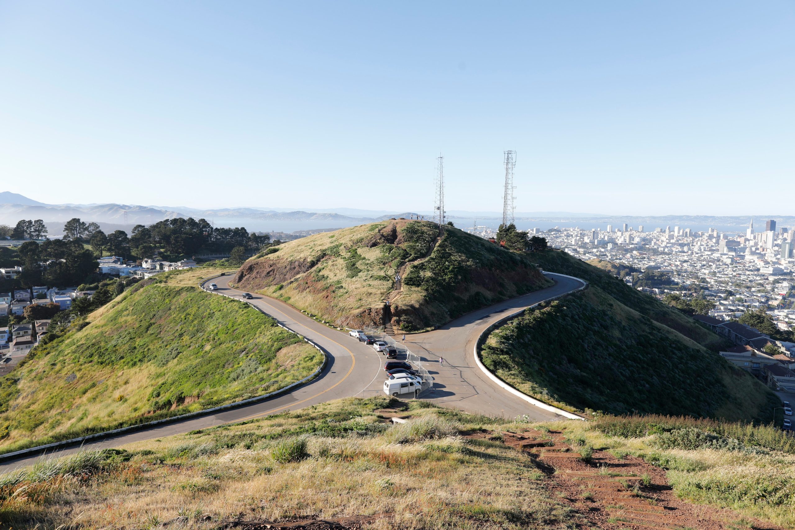
Twin Peaks is two adjacent hills topping out at 922 feet, the highest natural viewpoint in San Francisco. It offers 360 views of the city along with curving Twin Peaks Boulevard for creative long-exposure light-trail shots. The city installed license plate readers and additional cameras at the parking area to deter the smash-and-grabs the spot was known for in years past; daytime visits are generally safe, but lock valuables out of sight and don’t leave camera bags in parked cars.
Twin Peaks on Google Maps13. San Francisco’s Chinatown
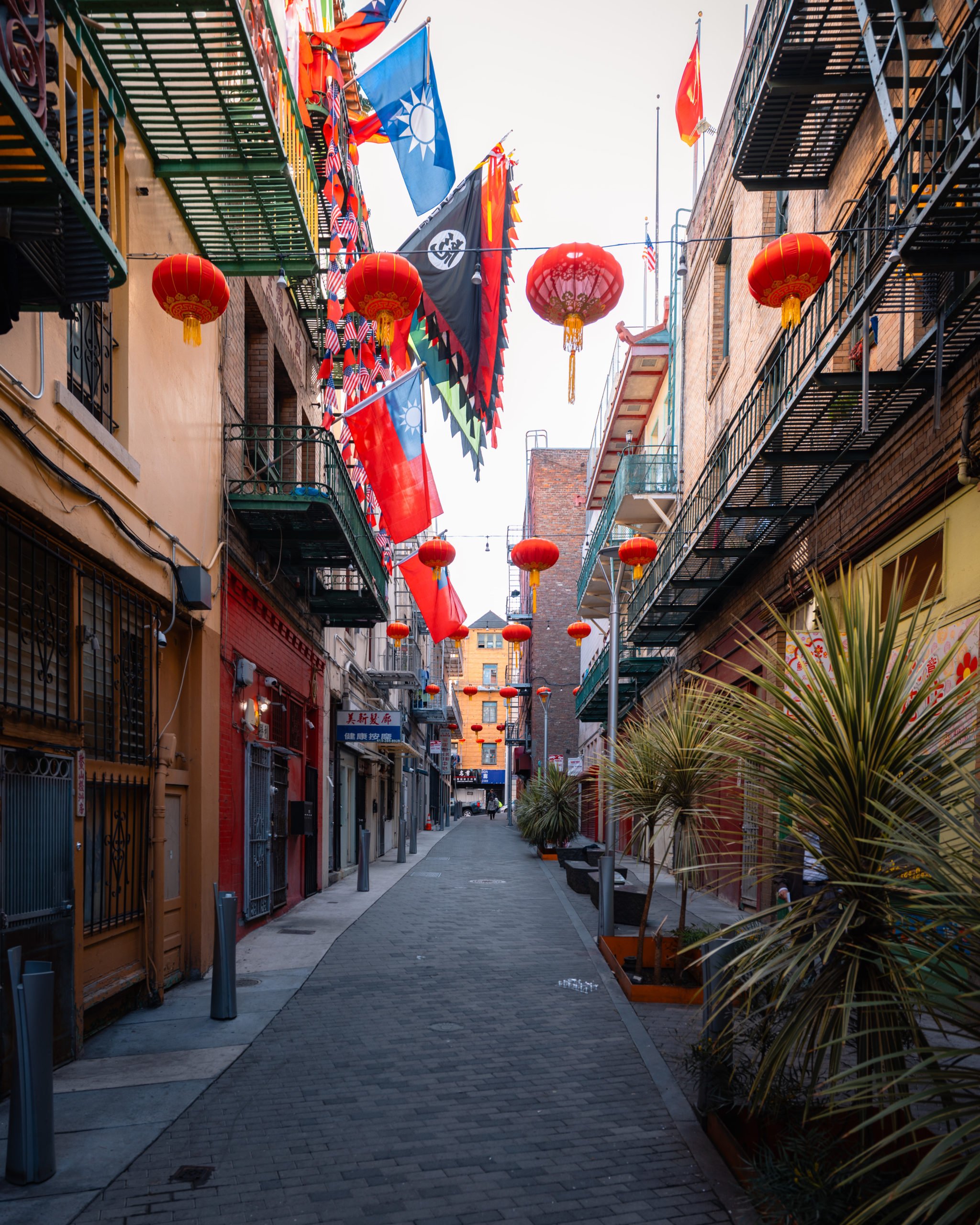
Established in 1848, San Francisco’s Chinatown is the oldest Chinatown in North America and one of the largest outside Asia. Enter through the Dragon Gate at Grant and Bush. The lantern-lined Grant Avenue stretch is the most photogenic, while Ross Alley is where you’ll find the Golden Gate Fortune Cookie Factory hand-folding cookies the same way they have for decades. Stop in to watch them work or grab dim sum at one of the spots along Stockton.
SF Chinatown on Google Maps14. Alcatraz Island
You’ll need to take the ferry to get to Alcatraz. Boats leave from Pier 33, and tickets sell out weeks in advance especially in summer, so book well ahead. The free self-guided audio tour inside the cellhouse (narrated by former guards and inmates) is genuinely worth the visit. For photographers, the sunset tour is the move: softer light on the cell blocks plus the city skyline lit up on the ride back.
Alcatraz Island on Google Maps15. Treasure Island
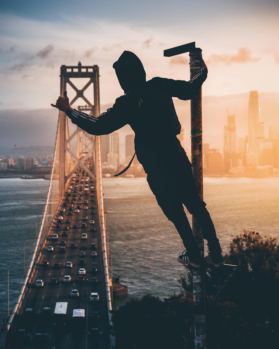
Just across the Bay Bridge from downtown, Treasure Island offers some of the cleanest skyline shots in the Bay Area. The west shore puts the entire SF skyline behind the Bay Bridge in one frame. A 24-70mm captures the full composition, a 70-200mm tightens up on Salesforce Tower and the Transamerica Pyramid. Yerba Buena Island (connected by a short bridge) has a smaller pull-off with a similar angle.
Treasure Island on Google Maps16. Cupid’s Span
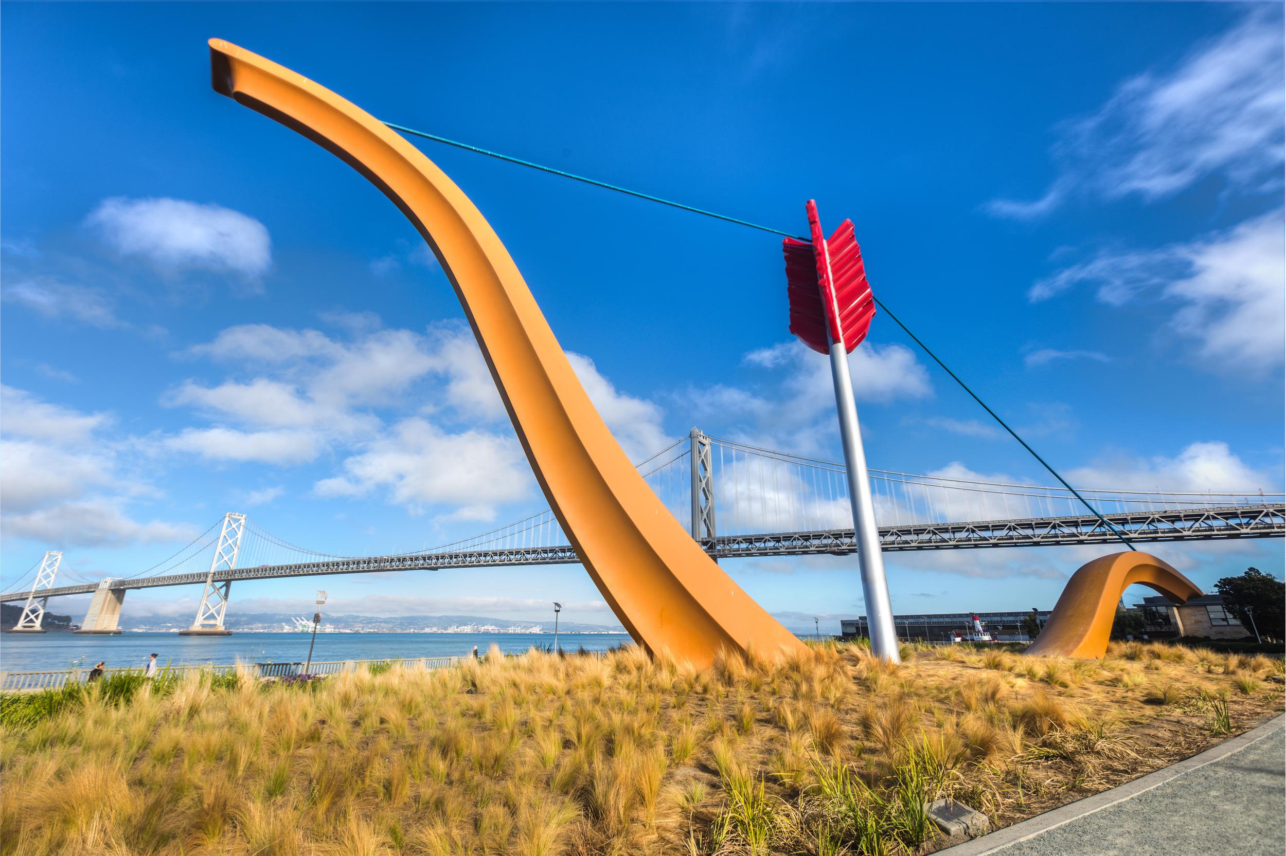
It’s hard to miss Cupid’s Span when walking downtown near the Bay Bridge. Installed in 2002 along the Embarcadero, the 60-foot sculpture by Claes Oldenburg and Coosje van Bruggen makes a planted bow-and-arrow look like Cupid shot the ground. It’s a great foreground element for the Bay Bridge behind it. Get low with a wide angle lens to exaggerate the scale.
Cupid’s Span on Google Maps17. Sutro Baths
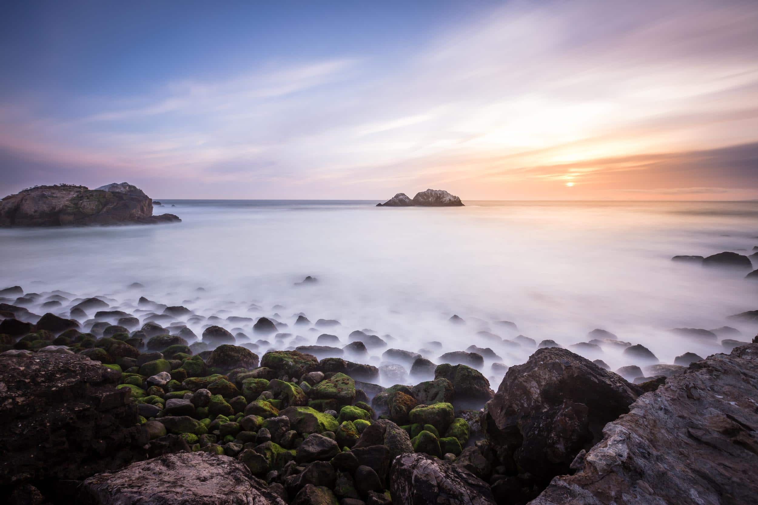
If you want to hike some of the coast, do the Lands End Trail from the trailhead near the Legion of Honor. At the end of the trail is the Sutro Baths, which you can also reach by car but is so much more fun to walk in to. Built by former SF mayor Adolph Sutro and opened to the public in 1896 as the world’s largest indoor swimming complex, the glass-roofed building burned down in June 1966 during demolition (the fire was ruled arson). Today the concrete pool foundations sit half-flooded against the Pacific, making it one of the most photogenic ruins on the West Coast, especially at sunset.
Sutro Baths on Google Maps18. SF-Oakland Bay Bridge
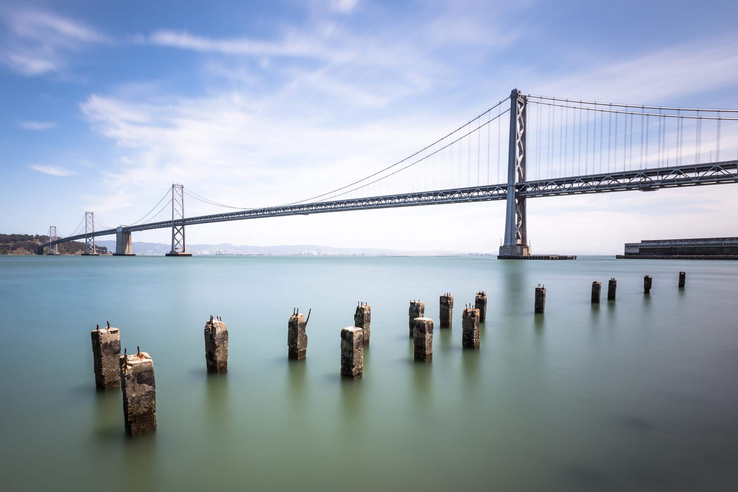
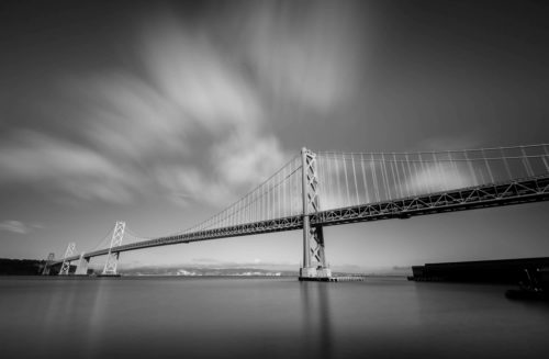
Often overlooked, the Bay Bridge is the more photogenic of San Francisco’s two big bridges at night. The Bay Lights, Leo Villareal’s 48,000-LED art installation on the western span’s cable plane, relit on March 20, 2026 after going dark in 2023, with a new system designed to outlast the bridge’s salt-air environment. Shoot from the Embarcadero piers or Rincon Park to get the bridge’s sweep with the lights animating across the cables. I use a 10-stop ND filter here for long exposures that smooth the bay water.
SF-Oakland Bay Bridge on Google Maps19. The Ferry Building
The Ferry Building‘s 245-foot clock tower terminates the entire Market Street view from downtown SF. The long lens compression shot looking up Market is a classic. From above, the front of the building reads “Port of San Francisco” in giant letters, but you can get most of the look on foot from the piers on either side. The Saturday morning farmers market out front is a great photo subject in its own right, and the building is full of food vendors inside. Grab a cup of Blue Bottle Coffee while you’re there.
The Ferry Building on Google Maps20. San Francisco from the Sky
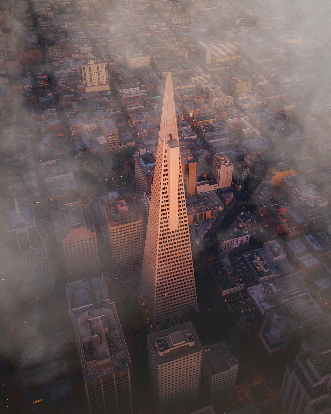
San Francisco’s dynamic skyline makes for stunning aerials. Especially since you can get unique views over bridges which may be illegal to drone. A popular company photographers use to fly in SF is FlyNYON.
San Francisco Photography Locations Map
Here are all of the SF photography spots mentioned in this post on a map.
San Francisco Photography FAQ
When is the best time of year to photograph San Francisco?
September and October are the city’s best months for photography. Karl the fog mostly stays offshore, daytime temperatures are mild, and the light is cleaner than in summer. June through August is peak fog season, which is great if you want moody bridge shots and frustrating if you want clear skylines. Winter (December through February) brings dramatic storms and the cleanest air after rain.
What’s the best time of day for the Golden Gate Bridge?
Sunrise from the Marin Headlands (Battery Spencer or Slacker Hill) puts the sun behind you and lights up the towers in warm side light. Sunset from Baker Beach or Golden Gate Overlook on the SF side silhouettes the bridge against the sky. Blue hour about 20 minutes after sunset is when the bridge’s amber sodium lights balance perfectly with the deep blue sky.
Can you fly a drone in San Francisco?
Mostly no. The entire city sits inside San Francisco International Airport’s Class B controlled airspace, and most of the iconic spots (Golden Gate Bridge, the Presidio, Alcatraz, the Bay Bridge) are inside National Park land or other no-fly zones where drones are prohibited. If you want aerial shots, charter a helicopter. FlyNYON, based across the bay in Hayward, runs doors-off flights designed for photographers.
Is San Francisco safe for photographers carrying gear?
Generally yes during the day in tourist areas, but car break-ins are the city’s biggest issue, so never leave camera bags visible in a parked car, even for five minutes. Twin Peaks had a stretch of armed robberies in 2022 and 2023. The city has since installed license plate readers and cameras, but it’s still a spot where I’d recommend going with someone else. Stick to daylight hours for solo shoots at less-trafficked viewpoints.
How long do you need to photograph the main San Francisco spots?
Two full days lets you hit the top 10 spots without rushing. One day works if you focus on a tight loop: Marin Headlands at sunrise, Palace of Fine Arts and Lombard Street midday, Alamo Square at golden hour, and the Embarcadero/Bay Bridge after dark. Alcatraz adds half a day on its own. Three days gives you time to add Lands End, Sutro Baths, and a Treasure Island sunset.
If you’re planning a one-day photo route, hit the Marin Headlands and Slacker Hill for sunrise, the Palace of Fine Arts and Lombard Street midday, Alamo Square and Treasure Island for golden hour, and the Bay Bridge from the Embarcadero after dark. Two days lets you add Sutro Baths and the Lands End Trail in the morning of day two and Alcatraz on the sunset boat tour. Pack a layer, since even sunny days turn cold fast once Karl the fog rolls in.
If you’re doing a longer California trip, head north to Point Reyes or south to Los Angeles along Highway One.
If I missed any SF locations, let me know in the comments.
Enjoyed this article?
Save a pin below to Pinterest!